Please login if you have access to particular applications.
Provider: All providers | |
Coastal Shelfs 0-200m | |
| Name: | 40-200 m North-West shelf - view region report showing all data |
| Region: | North-west |
| Area: | not set |
| Gear type: | sediment grab and core samples
|
| Layers used: |
Seabed sediments sampling
MNF Sediment Sampling sites - all voyages Marine Coastal Oceanic Shoals Samples - major trace elements AIMS - Sediment Mudcore sediment surface Core data - Indian Ocean |
| Summary: | Records - 1429 Deepest: db |
| Last updated: | 24-Mar-2024 04:13. |
| Buffer: | |
Time series plot (1930 to present) - Y axis is deployments per year
Region data
Show data list
| Year | Total inside region |
| 1967 | 110 |
| 1968 | 144 |
| 1988 | 3 |
| 1989 | 3 |
| 1990 | 19 |
| 1995 | 27 |
| 1996 | 2 |
| 1996 | 19 |
| 1996 | 37 |
| 2000 | 2 |
| 2000 | 45 |
| 2004 | 27 |
| 2005 | 1 |
| 2005 | 8 |
| 2006 | 14 |
| 2006 | 35 |
| 2007 | 1 |
| 2007 | 27 |
| 2008 | 188 |
| 2011 | 56 |
| 2012 | 58 |
| 2012 | 61 |
| 2013 | 150 |
| 2014 | 12 |
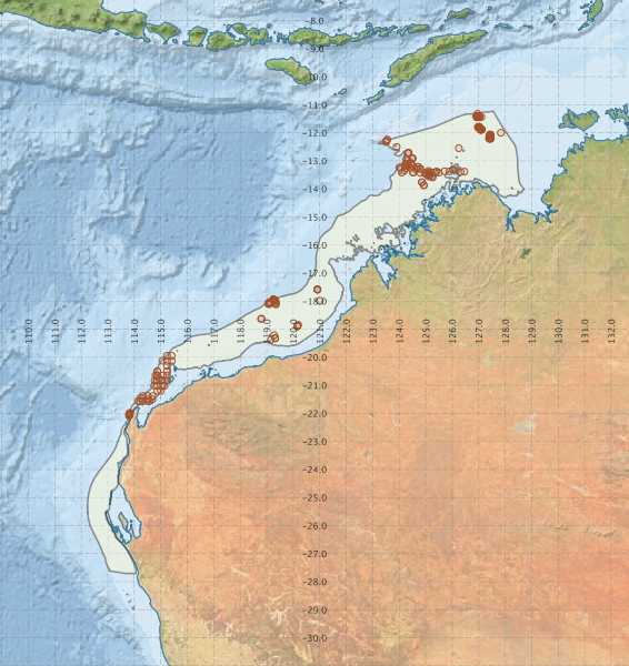
Region extents: 112° 13.7' E 27° 42.6' S to 128° 42.9' E 11° 13.4' S
Acknowledgements: Background map - Bright Earth e-Atlas Basemap v1.0 (AIMS, GBRMPA, JCU, DSITIA, GA, UCSD, NASA, OSM, ESRI) CC BY