Please login if you have access to particular applications.
Provider: All providers | |
Coastal Shelfs 0-200m | |
| Name: | 40-200 m North-West shelf - view region report showing all data |
| Region: | North-west |
| Area: | not set |
| Gear type: | demersal trawl or sled
|
| Layers used: |
Oceanic Shoals Marine Biodiversity Survey - benthos sites
- link to layer metadata CMAR Catch Operations Data overview (1965 to current) - link to layer metadata |
| Summary: | Records - 10763 Deepest: 129 db |
| Last updated: | 24-Mar-2024 04:13. |
| Buffer: | |
Time series plot (1930 to present) - Y axis is deployments per year
Region data
Show data list
| Year | Total inside region |
| 1965 | 1 |
| 1966 | 12 |
| 1967 | 306 |
| 1968 | 59 |
| 1969 | 88 |
| 1970 | 62 |
| 1971 | 34 |
| 1972 | 41 |
| 1973 | 71 |
| 1974 | 44 |
| 1976 | 8 |
| 1977 | 7 |
| 1978 | 89 |
| 1979 | 88 |
| 1980 | 102 |
| 1982 | 202 |
| 1983 | 398 |
| 1984 | 17 |
| 1986 | 89 |
| 1987 | 95 |
| 1988 | 100 |
| 1989 | 84 |
| 1990 | 109 |
| 1991 | 87 |
| 1995 | 78 |
| 1997 | 85 |
| 2005 | 48 |
| 2007 | 58 |
| 2012 | 10763 |
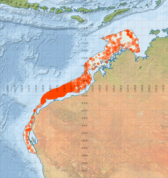
Region extents: 112° 13.7' E 27° 42.6' S to 128° 42.9' E 11° 13.4' S
Acknowledgements: Background map - Bright Earth e-Atlas Basemap v1.0 (AIMS, GBRMPA, JCU, DSITIA, GA, UCSD, NASA, OSM, ESRI) CC BY