Please login if you have access to particular applications.
Provider: All providers | |
Great Barrier Reef Marine Park | |
| Name: | MPZ29 - Far Northern - view region report showing all data |
| Region: | |
| Area: | not set |
| Gear type: | sediment grab and core samples
|
| Layers used: |
Seabed sediments sampling
sediment surface CSIRO Sediment Sampling |
| Summary: | Records - 843 Deepest: db |
| Last updated: | 9-May-2024 15:35. |
| Buffer: | |
Time series plot (1930 to present) - Y axis is deployments per year
Region data
Show data list
| Year | Total inside region |
| 1994 | 157 |
| 1994 | 169 |
| 1996 | 1 |
| 1998 | 217 |
| 2003 | 5 |
| 2005 | 159 |
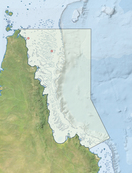
Region extents: 142° 31.9' E 14° 40.1' S to 145° 39.0' E 10° 40.9' S
Acknowledgements: Background map - Bright Earth e-Atlas Basemap v1.0 (AIMS, GBRMPA, JCU, DSITIA, GA, UCSD, NASA, OSM, ESRI) CC BY