Please login if you have access to particular applications.
Provider: All providers | |
Great Barrier Reef Marine Park | |
| Name: | MPZ30 - Cairns / Cooktown - view region report showing all data |
| Region: | |
| Area: | not set |
| Gear type: | demersal trawl or sled
|
| Layers used: |
CMAR Catch Operations Data overview (1965 to current)
- link to layer metadata |
| Summary: | Records - 171 Deepest: db |
| Last updated: | 28-Apr-2024 09:17. |
| Buffer: | |
Time series plot (1930 to present) - Y axis is deployments per year
Region data
Show data list
| Year | Total inside region |
| 1985 | 7 |
| 1997 | 3 |
| 2003 | 108 |
| 2004 | 33 |
| 2005 | 20 |
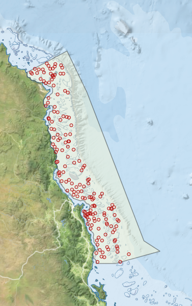
Region extents: 144° 56.5' E 17° 52.9' S to 147° 17.0' E 14° 18.3' S
Acknowledgements: Background map - Bright Earth e-Atlas Basemap v1.0 (AIMS, GBRMPA, JCU, DSITIA, GA, UCSD, NASA, OSM, ESRI) CC BY