Please login if you have access to particular applications.
Provider: All providers | |
Great Barrier Reef Marine Park | |
| Name: | MPZ30 - Cairns / Cooktown - view region report showing all data |
| Region: | |
| Area: | not set |
| Gear type: | CTD sensor
|
| Layers used: |
RAN CTD data
AIMS CTD data AIMS CTD cast summary ARGO profile map - link to layer metadata Completed Realtime Glider Deployments - link to layer metadata anfog rt trajectory map - link to layer metadata Realtime Glider Deployments - link to layer metadata CMAR CTD Data Overview (1982 - present) - link to layer metadata |
| Summary: | Records - 628 Deepest: db |
| Last updated: | 28-Apr-2024 09:17. |
| Buffer: | |
Time series plot (1930 to present) - Y axis is deployments as vertical profile or tows per year
Region data
Show data list
| Year | Total inside region |
| 1985 | 3 |
| 1985 | 4 |
| 1986 | 14 |
| 1986 | 22 |
| 1987 | 20 |
| 1987 | 23 |
| 1988 | 2 |
| 1989 | 34 |
| 1989 | 35 |
| 1990 | 4 |
| 1990 | 55 |
| 1991 | 4 |
| 1991 | 8 |
| 1991 | 11 |
| 1993 | 24 |
| 1993 | 26 |
| 1994 | 47 |
| 1994 | 55 |
| 1995 | 3 |
| 1995 | 18 |
| 1995 | 31 |
| 1996 | 13 |
| 1996 | 22 |
| 1997 | 4 |
| 1997 | 34 |
| 1997 | 39 |
| 1998 | 14 |
| 1999 | 14 |
| 1999 | 15 |
| 2000 | 11 |
| 2000 | 12 |
| 2001 | 7 |
| 2002 | 2 |
| 2002 | 7 |
| 2002 | 8 |
| 2004 | 6 |
| 2005 | 1 |
| 2006 | 1 |
| 2006 | 9 |
| 2007 | 1 |
| 2007 | 2 |
| 2007 | 3 |
| 2007 | 14 |
| 2008 | 3 |
| 2008 | 21 |
| 2008 | 67 |
| 2008 | 87 |
| 2009 | 23 |
| 2009 | 57 |
| 2010 | 25 |
| 2010 | 60 |
| 2011 | 4 |
| 2011 | 22 |
| 2011 | 177 |
| 2012 | 2 |
| 2012 | 12 |
| 2012 | 13 |
| 2012 | 48 |
| 2013 | 2 |
| 2013 | 3 |
| 2013 | 8 |
| 2013 | 25 |
| 2014 | 22 |
| 2014 | 42 |
| 2015 | 4 |
| 2015 | 9 |
| 2015 | 110 |
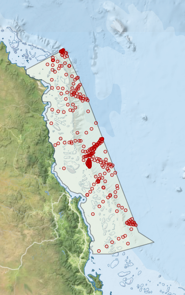
Region extents: 144° 56.5' E 17° 52.9' S to 147° 17.0' E 14° 18.3' S
Acknowledgements: Background map - Bright Earth e-Atlas Basemap v1.0 (AIMS, GBRMPA, JCU, DSITIA, GA, UCSD, NASA, OSM, ESRI) CC BY