Please login if you have access to particular applications.
Provider: All providers | |
Key Ecological Features | |
| Name: | Submerged coral reefs of the Gulf of Carpentaria - view region report showing all data |
| Region: | North |
| Area: | 922.36 km2 |
| Gear type: | CTD sensor
|
| Layers used: |
CMAR CTD Data Overview (1982 - present)
- link to layer metadata |
| Summary: | Records - 55 Deepest: db |
| Last updated: | 24-Mar-2024 04:29. |
| Buffer: | |
Time series plot (1930 to present) - Y axis is deployments as vertical profile or tows per year
Region data
Show data list
| Year | Total inside region |
| 1988 | 1 |
| 2003 | 6 |
| 2005 | 48 |
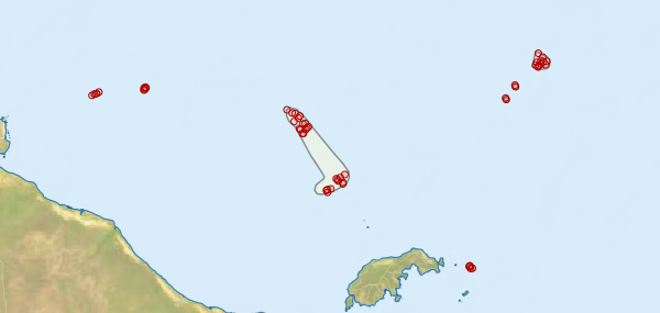
Region extents: 137° 36.1' E 16° 31.2' S to 140° 22.7' E 15° 14.8' S
Acknowledgements: Background map - Bright Earth e-Atlas Basemap v1.0 (AIMS, GBRMPA, JCU, DSITIA, GA, UCSD, NASA, OSM, ESRI) CC BY