Please login if you have access to particular applications.
Provider: All providers | |
Key Ecological Features | |
| Name: | Ancient coastline at 125 m depth contour - view region report showing all data |
| Region: | North-west |
| Area: | 16,189.79 km2 |
| Gear type: | remote or autonomous underwater video
|
| Layers used: |
IMOS - Autonomous Underwater Vehicle (AUV) Facility trajectory map
- link to layer metadata |
| Summary: | Records - 1 Deepest: db |
| Last updated: | 18-Mar-2024 02:34. |
| Buffer: | |
Time series plot (1930 to present) - Y axis is deployments per year
Region data
Show data list
| Year | Total inside region |
| 2012 | 1 |
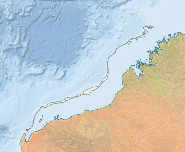
Region extents: 114° 09.8' E 21° 37.4' S to 124° 49.5' E 13° 13.4' S
Acknowledgements: Background map - Bright Earth e-Atlas Basemap v1.0 (AIMS, GBRMPA, JCU, DSITIA, GA, UCSD, NASA, OSM, ESRI) CC BY