Please login if you have access to particular applications.
Provider: All providers | |
Key Ecological Features | |
| Name: | Canyons linking the Cuvier Abyssal Plain and the Cape Range Peninsula - view region report showing all data |
| Region: | North-west |
| Area: | 5,391.54 km2 |
| Gear type: | ocean based acoustic current meter
|
| Layers used: |
CSIRO NCMI Acoustic Doppler Current Profiler data
- link to layer metadata NOAA drifting buoys (map) |
| Summary: | Records - 682 Deepest: db |
| Last updated: | 18-Mar-2024 06:27. |
| Buffer: | |
Time series plot (1930 to present) - Y axis is ensembles per day per year
Region data
Show data list
| Year | Total inside region |
| 1995 | 30 |
| 1996 | 2 |
| 1996 | 168 |
| 1999 | 6 |
| 2000 | 23 |
| 2003 | 2 |
| 2004 | 1 |
| 2005 | 150 |
| 2006 | 6 |
| 2007 | 4 |
| 2007 | 60 |
| 2008 | 1 |
| 2010 | 17 |
| 2010 | 192 |
| 2011 | 18 |
| 2012 | 29 |
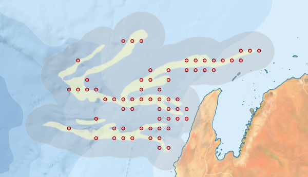
Region extents: 112° 12.6' E 22° 26.8' S to 114° 34.4' E 21° 10.9' S
Acknowledgements: Background map - Bright Earth e-Atlas Basemap v1.0 (AIMS, GBRMPA, JCU, DSITIA, GA, UCSD, NASA, OSM, ESRI) CC BY