Please login if you have access to particular applications.
Provider: All providers | |
Key Ecological Features | |
| Name: | Continental Slope Demersal Fish Communities - view region report showing all data |
| Region: | North-west |
| Area: | 33,182.04 km2 |
| Gear type: | ocean based acoustic current meter
|
| Layers used: |
CSIRO NCMI Acoustic Doppler Current Profiler data
- link to layer metadata NOAA drifting buoys (map) |
| Summary: | Records - 2723 Deepest: db |
| Last updated: | 10-May-2024 20:20. |
| Buffer: | |
Time series plot (1930 to present) - Y axis is ensembles per day per year
Region data
Show data list
| Year | Total inside region |
| 1987 | 32 |
| 1988 | 12 |
| 1995 | 252 |
| 1996 | 305 |
| 1999 | 20 |
| 1999 | 176 |
| 2000 | 14 |
| 2000 | 207 |
| 2001 | 4 |
| 2002 | 10 |
| 2003 | 3 |
| 2003 | 36 |
| 2004 | 1 |
| 2005 | 5 |
| 2005 | 263 |
| 2006 | 33 |
| 2007 | 67 |
| 2008 | 25 |
| 2010 | 17 |
| 2010 | 1144 |
| 2011 | 66 |
| 2012 | 13 |
| 2012 | 130 |
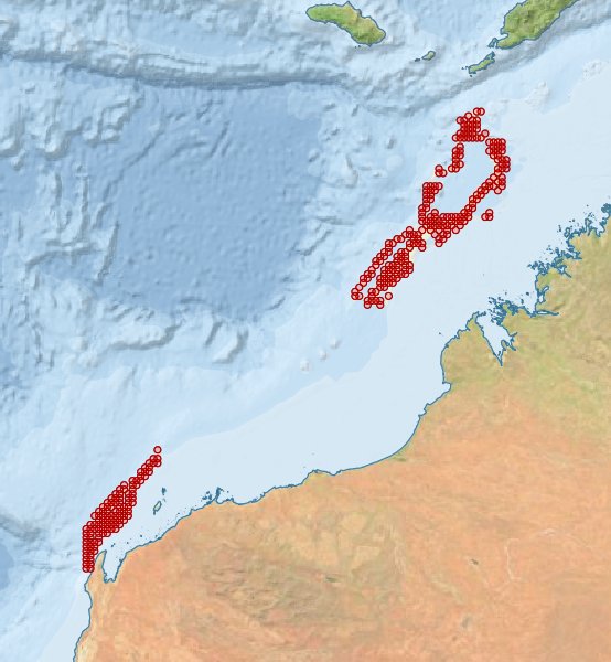
Region extents: 113° 40.1' E 22° 14.0' S to 123° 46.2' E 11° 46.4' S
Acknowledgements: Background map - Bright Earth e-Atlas Basemap v1.0 (AIMS, GBRMPA, JCU, DSITIA, GA, UCSD, NASA, OSM, ESRI) CC BY