Provider: All providers | |
Key Ecological Features | |
| Name: | Upwelling off Fraser Island - view region report showing all data |
| Region: | Temperate east |
| Area: | 12,768.24 km2 |
| Gear type: | Current meter at moorings
|
| Layers used: |
ABOS currents map
- link to layer metadata |
| Summary: | Records - 2 Deepest: db |
| Last updated: | 28-Apr-2024 02:03. |
| Buffer: | |
Time series plot (1930 to present) - Y axis is Mooring deployments per year
Region data
Show data list
| Year | Total inside region |
| 2015 | 1 |
| 2016 | 1 |
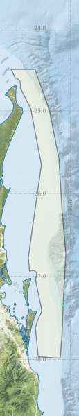
Region extents: 153° 11.8' E 27° 59.2' S to 153° 56.4' E 24° 29.9' S
Acknowledgements: Background map - Bright Earth e-Atlas Basemap v1.0 (AIMS, GBRMPA, JCU, DSITIA, GA, UCSD, NASA, OSM, ESRI) CC BY