Please login if you have access to particular applications.
Provider: All providers | |
Key Ecological Features | |
| Name: | Canyons on the eastern continental slope - view region report showing all data |
| Region: | Temperate east |
| Area: | 5,871.03 km2 |
| Gear type: | eXpendable BathyThermograph
|
| Layers used: |
XBT Realtime profile
- link to layer metadata XBT Profile Data - link to layer metadata CMAR XBT profiles - link to layer metadata |
| Summary: | Records - 97 Deepest: db |
| Last updated: | 18-Mar-2024 03:57. |
| Buffer: | |
Time series plot (1930 to present) - Y axis is deployments per year
Region data
Show data list
| Year | Total inside region |
| 1986 | 3 |
| 1988 | 1 |
| 1989 | 2 |
| 1991 | 1 |
| 1991 | 3 |
| 1992 | 4 |
| 1993 | 2 |
| 1994 | 1 |
| 1995 | 3 |
| 1996 | 3 |
| 1997 | 3 |
| 1998 | 4 |
| 1999 | 4 |
| 2000 | 2 |
| 2001 | 5 |
| 2002 | 1 |
| 2003 | 1 |
| 2004 | 1 |
| 2005 | 21 |
| 2006 | 1 |
| 2008 | 1 |
| 2008 | 4 |
| 2009 | 2 |
| 2011 | 1 |
| 2011 | 4 |
| 2012 | 8 |
| 2013 | 12 |
| 2014 | 1 |
| 2015 | 4 |
| 2016 | 2 |
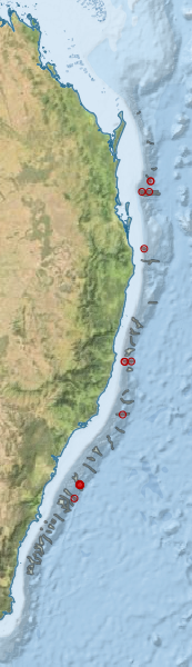
Region extents: 150° 24.4' E 36° 32.6' S to 154° 23.0' E 24° 41.6' S
Acknowledgements: Background map - Bright Earth e-Atlas Basemap v1.0 (AIMS, GBRMPA, JCU, DSITIA, GA, UCSD, NASA, OSM, ESRI) CC BY