Please login if you have access to particular applications.
Provider: All providers | |
Key Ecological Features | |
| Name: | Ancient coastline at 90-120m depth - view region report showing all data |
| Region: | South-west |
| Area: | 45,347.24 km2 |
| Gear type: | ocean based acoustic current meter
|
| Layers used: |
CSIRO NCMI Acoustic Doppler Current Profiler data
- link to layer metadata NOAA drifting buoys (map) |
| Summary: | Records - 2310 Deepest: db |
| Last updated: | 6-May-2024 22:58. |
| Buffer: | |
Time series plot (1930 to present) - Y axis is ensembles per day per year
Region data
Show data list
| Year | Total inside region |
| 1987 | 3 |
| 1994 | 202 |
| 1995 | 40 |
| 1996 | 2 |
| 1996 | 74 |
| 1998 | 13 |
| 1998 | 53 |
| 2000 | 38 |
| 2001 | 1 |
| 2001 | 44 |
| 2003 | 2 |
| 2003 | 57 |
| 2004 | 19 |
| 2004 | 71 |
| 2005 | 3 |
| 2005 | 320 |
| 2006 | 235 |
| 2007 | 9 |
| 2007 | 132 |
| 2008 | 15 |
| 2008 | 479 |
| 2009 | 8 |
| 2010 | 25 |
| 2010 | 135 |
| 2011 | 54 |
| 2011 | 180 |
| 2012 | 45 |
| 2012 | 59 |
| 2013 | 188 |
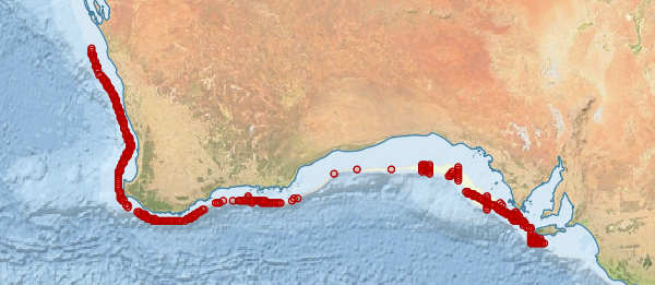
Region extents: 113° 16.3' E 36° 29.6' S to 137° 05.2' E 27° 39.9' S
Acknowledgements: Background map - Bright Earth e-Atlas Basemap v1.0 (AIMS, GBRMPA, JCU, DSITIA, GA, UCSD, NASA, OSM, ESRI) CC BY