Please login if you have access to particular applications.
Provider: All providers | |
Australian Marine Parks | |
| Name: | Kimberley Multiple Use Zone (IUCN VI) - view region report showing all data |
| Region: | North-west |
| Comments: | This reserve was originally proclaimed on 17 November 2012. There are NO CHANGES ON THE WATER until the North-west Australian Marine Parks Network Management Plan comes into effect. Australia's network of Australian Marine Parks (revised 2014-03-28) http://www.environment.gov.au/fed/catalog/search/resource/details.page?uuid=%7B2E8DD19C-1B93-4D90-BD1C-128DDC4A2998%7D |
| Area: | 66,563.21 km2 |
| Gear type: | CTD sensor
|
| Layers used: |
RAN CTD data
AIMS CTD data CMAR CTD Data Overview (1982 - present) - link to layer metadata AIMS CTD cast summary Glider deployments - link to layer metadata |
| Summary: | Records - 554 Deepest: db |
| Last updated: | 23-Mar-2024 13:40. |
| Buffer: | |
Time series plot (1930 to present) - Y axis is deployments as vertical profile or tows per year
Region data
Show data list
| Year | Total inside region |
| 1987 | 19 |
| 1993 | 2 |
| 1995 | 2 |
| 1996 | 1 |
| 1999 | 19 |
| 2007 | 134 |
| 2008 | 305 |
| 2010 | 40 |
| 2011 | 1 |
| 2012 | 1 |
| 2013 | 4 |
| 2013 | 10 |
| 2013 | 11 |
| 2014 | 13 |
| 2015 | 86 |
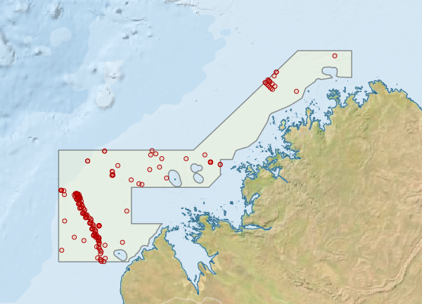
Region extents: 121° 00.0' E 17° 00.0' S to 126° 26.0' E 13° 13.0' S
Acknowledgements: Background map - Bright Earth e-Atlas Basemap v1.0 (AIMS, GBRMPA, JCU, DSITIA, GA, UCSD, NASA, OSM, ESRI) CC BY