Please login if you have access to particular applications.
Provider: All providers | |
Coastal Shelfs 0-200m | |
| Name: | 40-200 m North-West shelf - view region report showing all data |
| Region: | North-west |
| Area: | not set |
| Gear type: | Glider
|
| Layers used: |
Glider deployments - link to layer metadata Completed Realtime Glider Deployments - link to layer metadata |
| Summary: | Records - 17 Deepest: db |
| Last updated: | 5-Nov-2025 09:19. |
| Buffer: | |
Time series plot (1930 to present) - Y axis is locations per year
Region data
Show data list
| Year | Total inside region |
| 2009 | 1 |
| 2010 | 12 |
| 2011 | 1 |
| 2012 | 3 |
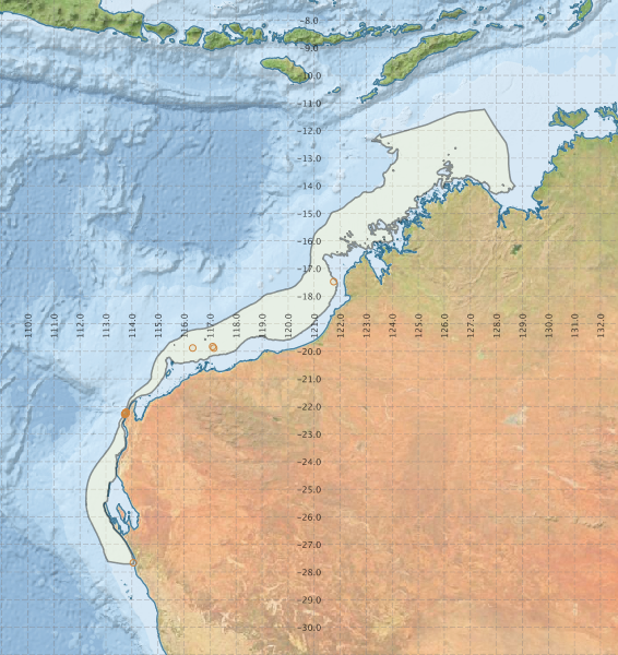
Region extents: 112° 13.7' E 27° 42.6' S to 128° 42.9' E 11° 13.4' S
Acknowledgements: Background map - Bright Earth e-Atlas Basemap v1.0 (AIMS, GBRMPA, JCU, DSITIA, GA, UCSD, NASA, OSM, ESRI) CC BY