Please login if you have access to particular applications.
Provider: All providers | |
Coastal Shelfs 0-200m | |
| Name: | 0-40 m North-West shelf - view region report showing all data |
| Region: | North-west |
| Area: | not set |
| Gear type: | Zooplankton samples
|
| Layers used: |
The Australian Zooplankton Database (1938 onwards) - Data - link to layer metadata SOOP AusCPR zoop trajectory map - link to layer metadata |
| Summary: | Records - 38 Deepest: db |
| Last updated: | 23-Apr-2026 15:09. |
| Buffer: | |
Time series plot (1930 to present) - Y axis is observations per year
Region data
Show data list
| Year | Total inside region |
| 1997 | 1 |
| 1998 | 1 |
| 1999 | 1 |
| 2002 | 1 |
| 2010 | 1 |
| 2011 | 34 |
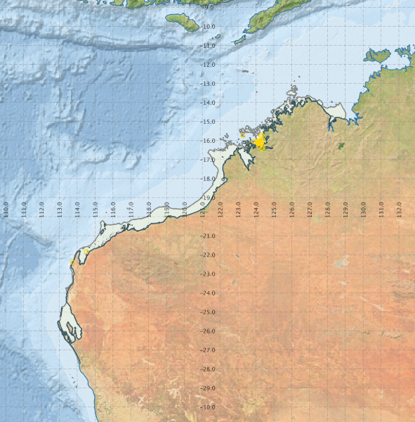
Region extents: 112° 54.5' E 27° 42.6' S to 129° 01.8' E 12° 18.7' S
Acknowledgements: Background map - Bright Earth e-Atlas Basemap v1.0 (AIMS, GBRMPA, JCU, DSITIA, GA, UCSD, NASA, OSM, ESRI) CC BY