Please login if you have access to particular applications.
Provider: All providers | |
Coastal Shelfs 0-200m | |
| Name: | 0-40 m South Australia, Victoria and Tasmania - view region report showing all data |
| Region: | South-east |
| Area: | not set |
| Gear type: | Zooplankton samples
|
| Layers used: |
The Australian Zooplankton Database (1938 onwards) - Data - link to layer metadata SOOP AusCPR zoop trajectory map - link to layer metadata |
| Summary: | Records - 14 Deepest: db |
| Last updated: | 17-Sep-2025 18:04. |
| Buffer: | |
Time series plot (1930 to present) - Y axis is observations per year
Region data
Show data list
| Year | Total inside region |
| 1971 | 2 |
| 1972 | 5 |
| 1973 | 2 |
| 2000 | 1 |
| 2001 | 1 |
| 2005 | 1 |
| 2010 | 1 |
| 2012 | 2 |
| 2013 | 1 |
| 2014 | 4 |
| 2015 | 1 |
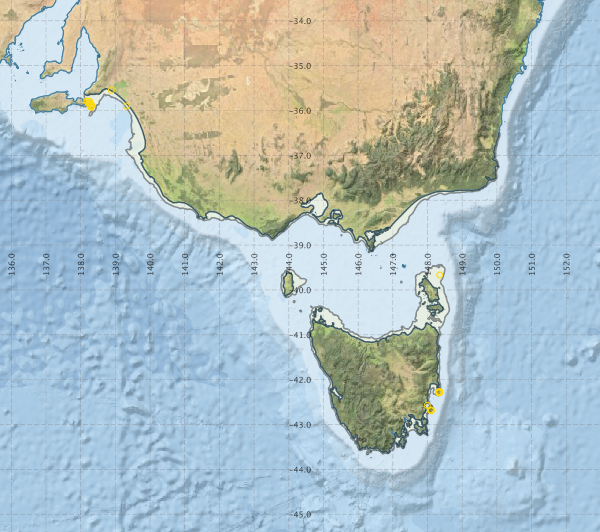
Region extents: 138° 04.6' E 43° 45.0' S to 150° 05.4' E 35° 30.8' S
Acknowledgements: Background map - Bright Earth e-Atlas Basemap v1.0 (AIMS, GBRMPA, JCU, DSITIA, GA, UCSD, NASA, OSM, ESRI) CC BY