Please login if you have access to particular applications.
Provider: All providers | |
Key Ecological Features | |
| Name: | Ancient coastline at 90-120m depth - view region report showing all data |
| Region: | South-west |
| Area: | 45,347.24 km2 |
| Gear type: | satellite tag
|
| Layers used: |
aatams sattag dm location map - link to layer metadata aatams sattag dm profile map - link to layer metadata Australian Sea Lion CTD Profiles - link to layer metadata aatams sattag dm dive profile map - link to layer metadata |
| Summary: | Records - 4636 Deepest: db |
| Last updated: | 4-May-2026 14:54. |
| Buffer: | |
Time series plot (1930 to present) - Y axis is dive locations or haulout sites per year
Region data
Show data list
| Year | Total inside region |
| 2009 | 797 |
| 2010 | 3462 |
| 2011 | 182 |
| 2012 | 195 |
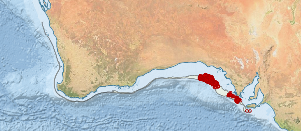
Region extents: 113° 16.3' E 36° 29.6' S to 137° 05.2' E 27° 39.9' S
Acknowledgements: Background map - Bright Earth e-Atlas Basemap v1.0 (AIMS, GBRMPA, JCU, DSITIA, GA, UCSD, NASA, OSM, ESRI) CC BY