Please login if you have access to particular applications.
Provider: All providers | |
Key Ecological Features | |
| Name: | Canyons on the eastern continental slope - view region report showing all data |
| Region: | Temperate east |
| Area: | 5,871.03 km2 |
| Gear type: | ocean based acoustic current meter
|
| Layers used: |
CSIRO NCMI Acoustic Doppler Current Profiler data - link to layer metadata NOAA drifting buoys (map) |
| Summary: | Records - 1387 Deepest: db |
| Last updated: | 20-Oct-2025 15:24. |
| Buffer: | |
Time series plot (1930 to present) - Y axis is ensembles per day per year
Region data
Show data list
| Year | Total inside region |
| 1989 | 26 |
| 1990 | 37 |
| 1991 | 53 |
| 1992 | 1 |
| 1992 | 47 |
| 1993 | 3 |
| 1993 | 8 |
| 1994 | 28 |
| 1997 | 34 |
| 1998 | 2 |
| 1999 | 4 |
| 2000 | 4 |
| 2001 | 5 |
| 2002 | 1 |
| 2004 | 37 |
| 2005 | 5 |
| 2006 | 3 |
| 2006 | 179 |
| 2007 | 1 |
| 2007 | 41 |
| 2008 | 10 |
| 2008 | 221 |
| 2009 | 2 |
| 2009 | 9 |
| 2010 | 2 |
| 2010 | 319 |
| 2011 | 1 |
| 2011 | 12 |
| 2012 | 2 |
| 2012 | 113 |
| 2013 | 211 |
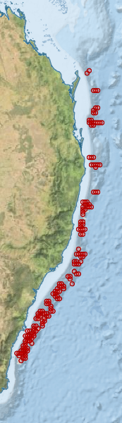
Region extents: 150° 24.4' E 36° 32.6' S to 154° 23.0' E 24° 41.6' S
Acknowledgements: Background map - Bright Earth e-Atlas Basemap v1.0 (AIMS, GBRMPA, JCU, DSITIA, GA, UCSD, NASA, OSM, ESRI) CC BY