Please login if you have access to particular applications.
Provider: All providers | |
Australian Marine Parks | |
| Name: | Freycinet Multiple Use Zone (IUCN VI) - view region report showing all data |
| Region: | South-east |
| Comments: | The South-east Network of Australian Marine Parks is managed under the South-east Australian Marine Parks Network Management Plan 2013-23, in place from 1 July 2013. Australia's network of Australian Marine Parks (revised 2014-03-28) http://www.environment.gov.au/fed/catalog/search/resource/details.page?uuid=%7B2E8DD19C-1B93-4D90-BD1C-128DDC4A2998%7D |
| Area: | 826.49 km2 |
| Gear type: | midwater acoustics
 |
| Layers used: |
MNF singlebeam EK60 18-333 kHz (RV Investigator) MNF singlebeam EK60 38-120 kHz (Southern Surveyor) MNF singlebeam EK60 12kHz (Southern Surveyor) |
| Summary: | Records - 37 Deepest: db |
| Last updated: | 2-May-2026 18:19. |
| Buffer: | |
Time series plot (1930 to present) - Y axis is one hour observation block per year
Region data
Show data list
| Year | Total inside region |
| 2012 | 6 |
| 2013 | 21 |
| 2015 | 9 |
| 2016 | 1 |
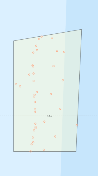
Region extents: 148° 25.8' E 42° 06.3' S to 148° 42.1' E 41° 44.7' S
Acknowledgements: Background map - Bright Earth e-Atlas Basemap v1.0 (AIMS, GBRMPA, JCU, DSITIA, GA, UCSD, NASA, OSM, ESRI) CC BY