
|
|
|||
The CSIRO Marine and Atmospheric Research (CMAR) c-squares mapper is a perl utility which plots dataset exents on a range of base maps, according to a string of c-squares (and optional other parameters) passed to it via the web.
(includes link to new interactive form, April 2003).
Convert my co-ordinates to a c-square code: |
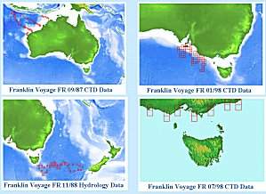 examples from the mapper |
Other features are also under development and may be available for testing prior to official release. For details watch, or subscribe to the "c-squares-discuss" listserver.
Topographic base maps currently available for the c-squares mapper have been adapted from those made available by the (U.S.) National Geophysical Data Center/NOAA GLOBE project, and are used by permission.
"Globe View" images of c-squares maps are constructed using the excellent open source "Xplanet" application written by Hari Nair, for which many thanks.
Initial version of the CMAR c-squares mapper constructed by Miroslaw Ryba and Tony Rees, CSIRO Marine and Atmospheric Research Data Centre, January-March 2002. Upgraded versions by Philip Bohm and Tony Rees, March-April 2003 (v2) and March-May 2006 (v3).
.