Northern Prawn Fishery monitoring |
SpeciesRegionMonthYear |
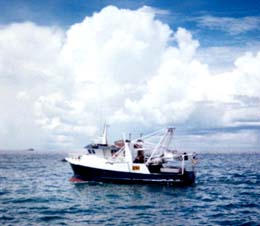
IntroductionEach year, CSIRO completes two monitoring surveys in the prawn fishing grounds of the Gulf of Carpentaria, which is within the managed area of the Northern Prawn Fishery (NPF). The surveys provide fishery-independent data for improving stock assessments in the NPF. The data augment the catch and effort data that are recorded in logbooks by fishers. The first monitoring survey, around January, provides indices of recruitment of the main commercial prawn species. The second survey, around July, provides indices of biomass and spawning of these species. This web site presents maps of the catches of four of the prawn species in the monitoring survey samples. The catches are displayed as catch rates (prawns per hour of trawling). The surveys have been funded by the MAC-Initated Research Fund of the Northern Prawn Fishery Management Advisory Committee, the Fisheries Research and Development Corporation, the AFMA Research Fund and CSIRO, recently through the CSIRO Wealth from Oceans Flagship. The surveys are performed with charter vessels provided and operated by A. Raptis & Sons Pty Ltd.
|