
|
|
A decade of Sea Surface TemperatureMarine and Atmospheric Research Remote Sensing Facility |

|

|

|

|

|

|

|
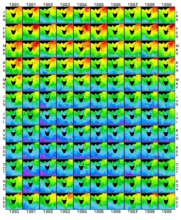
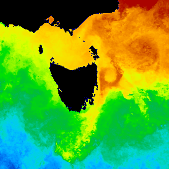
A simulation of the poster, built from actual satellite data.
These images are calculated from data broadcast by American NOAA weather satellites and received by the Remote Sensing Facility of CSIRO Marine Research in Hobart, Tasmania. Data are received several times per day and processed to give estimates of sea surface temperature. These estimates are then averaged over a month to remove cloud contamination and give an image of ocean structure for the month. Images of estimated sea surface temperature for areas from Cairns (QLD) clockwise to Geraldton (WA) can be obtained from CSIRO Marine Research.
For more information contact
![]()
Use of this web site and information available from it is subject to our
Legal Notice and Disclaimer