 |
|
|||||||
|


|
|||||||
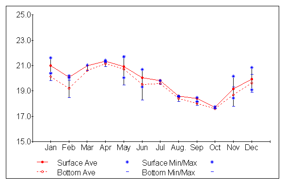
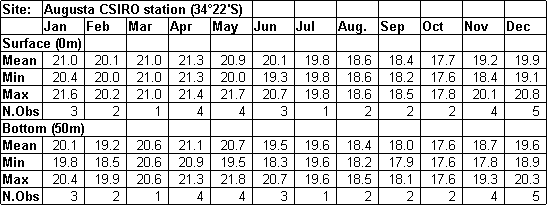
| Site This site was one of CSIRO's coastal monitoring stations, in about 55 m water depth southwest of Cape Leeuwin.
Data Acknowledgements Publications Pearce,A.F. & C.B.Pattiaratchi (1999). The Capes Current: a summer countercurrent flowing past Cape Leeuwin and Cape Naturaliste, Western Australia. Continental Shelf Research 19, 401-420. |
|||||||
|
|
|||||||

| Regional
Oceanography |
| | Fisheries | | | Satellite
Remote Sensing |
| | Bibliography | | | Home | | | Contact |
Updated 23rd May 2003- web@per.marine.csiro.au
Website established Nov 99 by Rabi
Rivett and Alan Pearce.
© Copyright 2003, CSIRO Australia.
Use of this web site and information available from it is subject to our
Legal Notice and Disclaimer.