Survey details and related metadata, reports, events and data.
RE2017_C01
Title: GAB deep water geological and benthic ecology program
Period: 2017-04-01 00:00 to 2017-05-01 00:00 Local
Duration: 30.00 days
From: Port Lincoln To: Port Lincoln
Region: Great Australia Bight
Ship: REM Etive [details]
Description: The RE2017-C01 survey also used two remotely operated vehicles (ROVs) to sample sites visited in IN2017_C01 for fine-scale habitat visualisation and collecting. Survey dates are approximate as operations have locations but no deployment times.
Project: RV Investigator Charter - Great Australian Bight Deepwater Marine Program [details]
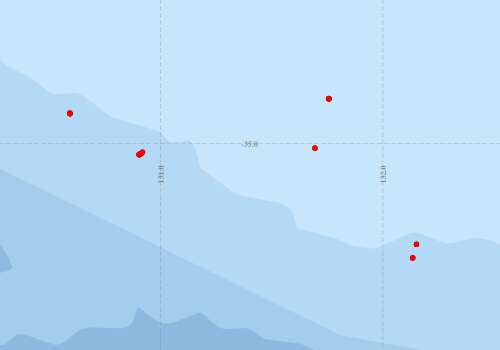
Voyage extents: 35° 30.9' S to 34° 47.8' S 130° 35.4' E to 132° 09.1' E
Marlin Metadata:-
Metadata from OBIS Australia datasets:- biological data is published via the OBIS-AU IPT server and delivered to one or more of OBIS, ALA and GBIF
Download from OBIS Australia IPT View at - Ocean Biodiversity Information System (OBIS) Atlas of Living Australia (ALA) GBIF
Download from OBIS Australia IPT View at - Ocean Biodiversity Information System (OBIS) Atlas of Living Australia (ALA) GBIF
Download from OBIS Australia IPT View at - Ocean Biodiversity Information System (OBIS) Atlas of Living Australia (ALA) GBIF
Download from OBIS Australia IPT View at - Ocean Biodiversity Information System (OBIS) Atlas of Living Australia (ALA) GBIF
Participants:- no records
Marine National Facility Reports - plans, summaries and data processing
- There is no map for this survey.
Publications, reports and datasets from this voyage.
Journal Article
- Barrett, Justine,Chase, Zanna,Zhang, Jing,Holl, Mark M. Banaszak,Willis, Kathryn,Williams, Alan,Hardesty, Britta D.,Wilcox, Chris (2020) Microplastic Pollution in Deep-Sea Sediments From the Great Australian Bight. Frontiers in Marine Science 7 pp-. 10.3389/fmars.2020.576170
- Osterhage, Deborah,MacIntosh, Hugh,Althaus, Franziska,Ross, Andrew,Mourier, Johann (2020) Multiple observations of Bigfin Squid (Magnapinna sp.) in the Great Australian Bight reveal distribution patterns, morphological characteristics, and rarely seen behaviour. PLOS ONE 15 ppe0241066-. 10.1371/journal.pone.0241066
- Untiedt, Candice Bobby,Quattrini, Andrea M.,McFadden, Catherine S.,Alderslade, Phil A.,Pante, Eric,Burridge, Christopher P. (2021) Phylogenetic Relationships Within Chrysogorgia (Alcyonacea: Octocorallia), a Morphologically Diverse Genus of Octocoral, Revealed Using a Target Enrichment Approach. Frontiers in Marine Science 7 pp-. 10.3389/fmars.2020.599984
Search for publications, reports and datasets from this and other voyages
Data publishing
This is a list of online datasets hosted by CSIRO. Other processed datasets hosted by collaborating organisations may be found on the 'Metadata' or "Reports, Publications and Maps' tab.
Use the Get data link on the right to extract data using the NCMI Data Trawler.
| Data Stream | Data Summary | Get data | ||||||||||||
|---|---|---|---|---|---|---|---|---|---|---|---|---|---|---|
| Marine biodiversity observations and/or samples |
|
Get Data from Trawler |
||||||||||||
| Catch Details |
|
Get Data from Trawler |
Deployments by start time:- Click on column header to sort. Use link on 'Deployment' to see full details. Use the CSV button at the bottom to export data (tab delimited).
Search for deployments from this voyage and others
| Deployment | Operation | Station | Cast | Gear | Project | Start and end times | Start Location | End Location | Depth | Description | |||
|---|---|---|---|---|---|---|---|---|---|---|---|---|---|
| Catch [details] | 34 | ROV Fugro | 2436 | 2017-03-02 06:44 | -35.0191 | 131.6950 | Area: SZ13OR | ||||||
| Catch [details] | 118 | ROV Fugro | 2436 | 2017-03-02 11:13 | -35.0211 | 131.6950 | Area: SZ13OR | ||||||
| Catch [details] | 133 | ROV Fugro | 2436 | 2017-03-02 11:56 | -34.7977 | 131.7590 | Area: VSM02SZ | ||||||
| Catch [details] | 163 | ROV Fugro | 2436 | 2017-03-02 20:25 | -34.7980 | 131.7560 | Area: VSM02SZ | ||||||
| Catch [details] | 171 | ROV Fugro | 2436 | 2017-03-02 21:29 | -35.0207 | 131.6950 | Area: SZ13OR | ||||||
| Catch [details] | 137 | ROV Fugro | 2436 | 2017-03-03 00:11 | -35.0199 | 131.6930 | Area: SZ13OR | ||||||
| Catch [details] | 36 | ROV Fugro | 2436 | 2017-03-03 11:38 | -34.7982 | 131.7560 | Area: VSM02SZ | ||||||
| Catch [details] | 42 | ROV Fugro | 2436 | 2017-03-03 11:47 | -35.5146 | 132.1350 | Area: SZ02OR | ||||||
| Catch [details] | 82 | ROV Fugro | 2436 | 2017-03-03 13:45 | -35.5136 | 132.1350 | Area: SZ02OR | ||||||
| Catch [details] | 98 | ROV Fugro | 2436 | 2017-03-03 15:24 | -35.5141 | 132.1350 | Area: SZ02OR | ||||||
| Catch [details] | 99 | ROV Fugro | 2436 | 2017-03-03 15:25 | -34.7982 | 131.7560 | Area: VSM02SZ | ||||||
| Catch [details] | 100 | ROV Fugro | 2436 | 2017-03-03 15:33 | -34.7979 | 131.7560 | Area: VSM02SZ | ||||||
| Catch [details] | 47 | ROV Fugro | 2436 | 2017-03-04 00:06 | -35.0193 | 131.6940 | Area: SZ13OR | ||||||
| Catch [details] | 80 | ROV Fugro | 2436 | 2017-03-04 07:00 | -35.5137 | 132.1350 | Area: SZ02OR | ||||||
| Catch [details] | 81 | ROV Fugro | 2436 | 2017-03-04 07:08 | -35.4536 | 132.1510 | Area: SZ02OR | ||||||
| Catch [details] | 37 | ROV Fugro | 2436 | 2017-03-17 08:29 | -34.8625 | 130.5930 | Area: OR16SZ | ||||||
| Catch [details] | 84 | ROV Fugro | 2436 | 2017-03-17 13:53 | -34.7964 | 131.7560 | Area: VSM02SZ | ||||||
| Catch [details] | 101 | ROV Fugro | 2436 | 2017-03-17 14:37 | -34.7977 | 131.7560 | Area: VSM02SZ | ||||||
| Catch [details] | 110 | ROV Fugro | 2436 | 2017-03-17 14:56 | -34.7980 | 131.7560 | Area: VSM02SZ | ||||||
| Catch [details] | 123 | ROV Fugro | 2436 | 2017-03-17 16:22 | -34.7976 | 131.7580 | Area: VSM02SZ | ||||||
| Catch [details] | 150 | ROV Fugro | 2436 | 2017-03-18 05:51 | -34.7986 | 131.7570 | Area: VSM02SZ | ||||||
| Catch [details] | 156 | ROV Fugro | 2436 | 2017-03-18 06:58 | -34.7984 | 131.7580 | Area: VSM02SZ | ||||||
| Catch [details] | 157 | ROV Fugro | 2436 | 2017-03-18 07:10 | -34.7982 | 131.7580 | Area: VSM02SZ | ||||||
| Catch [details] | 161 | ROV Fugro | 2436 | 2017-03-18 07:41 | -34.7985 | 131.7580 | Area: VSM02SZ | ||||||
| Catch [details] | 165 | ROV Fugro | 2436 | 2017-03-18 14:49 | -34.7982 | 131.7560 | Area: VSM02SZ | ||||||
| Catch [details] | 33 | ROV Fugro | 2436 | 2017-03-19 01:35 | -35.4529 | 132.1510 | Area: SZ02OR | ||||||
| Catch [details] | 5 | ROV Fugro | 2436 | 2017-03-19 12:26 | -35.4525 | 132.1510 | Area: SZ02OR | ||||||
| Catch [details] | 73 | ROV Fugro | 2436 | 2017-03-22 01:02 | -34.7975 | 131.7570 | Area: VSM02SZ | ||||||
| Catch [details] | 75 | ROV Fugro | 2436 | 2017-03-22 01:18 | -34.7965 | 131.7570 | Area: VSM02SZ | ||||||
| Catch [details] | 78 | ROV Fugro | 2436 | 2017-03-22 03:47 | -35.4528 | 132.1510 | Area: SZ02OR | ||||||
| Catch [details] | 24 | ROV Fugro | 2436 | 2017-03-22 10:25 | -35.5142 | 132.1330 | Area: SZ02OR | ||||||
| Catch [details] | 66 | ROV Fugro | 2436 | 2017-03-22 12:35 | -35.4536 | 132.1510 | Area: SZ02OR | ||||||
| Catch [details] | 72 | ROV Fugro | 2436 | 2017-03-22 12:58 | -35.4537 | 132.1520 | Area: SZ02OR | ||||||
| Catch [details] | 2 | ROV Fugro | 2436 | 2017-03-23 02:29 | -35.0371 | 130.9190 | Area: OR26 | ||||||
| Catch [details] | 4 | ROV Fugro | 2436 | 2017-03-23 02:35 | -35.5135 | 132.1330 | Area: SZ02OR | ||||||
| Catch [details] | 23 | ROV Fugro | 2436 | 2017-03-23 04:15 | -35.0501 | 130.9050 | Area: OR26 | ||||||
| Catch [details] | 38 | ROV Fugro | 2436 | 2017-03-23 05:34 | -34.8612 | 130.5910 | Area: OR16SZ | ||||||
| Catch [details] | 61 | ROV Fugro | 2436 | 2017-03-23 08:56 | -35.0491 | 130.9020 | Area: OR26 | ||||||
| Catch [details] | 64 | ROV Fugro | 2436 | 2017-03-23 09:12 | -35.0501 | 130.9020 | Area: OR26 | ||||||
| Catch [details] | 69 | ROV Fugro | 2436 | 2017-03-23 09:24 | -34.7974 | 131.7570 | Area: VSM02SZ | ||||||
| Catch [details] | 134 | ROV Fugro | 2436 | 2017-03-23 20:31 | -35.0473 | 130.9040 | Area: OR26 | ||||||
| Catch [details] | 139 | ROV Fugro | 2436 | 2017-03-23 21:36 | -35.0478 | 130.9060 | Area: OR26 | ||||||
| Catch [details] | 141 | ROV Fugro | 2436 | 2017-03-23 21:39 | -35.0477 | 130.9060 | Area: OR26 | ||||||
| Catch [details] | 144 | ROV Fugro | 2436 | 2017-03-24 03:56 | -35.0478 | 130.9040 | Area: OR26 | ||||||
| Catch [details] | 149 | ROV Fugro | 2436 | 2017-03-24 07:30 | -35.0492 | 130.9050 | Area: OR26 | ||||||
| Catch [details] | 188 | ROV Fugro | 2436 | 2017-03-24 15:16 | -35.0501 | 130.9060 | Area: OR26 | ||||||
| Catch [details] | 217 | ROV Fugro | 2436 | 2017-03-24 22:38 | -35.0477 | 130.9070 | Area: OR26 | ||||||
| Catch [details] | 219 | ROV Fugro | 2436 | 2017-03-25 02:18 | -35.0482 | 130.9060 | Area: OR26 | ||||||
| Catch [details] | 237 | ROV Fugro | 2436 | 2017-03-25 16:24 | -35.0482 | 130.9040 | Area: OR26 | ||||||
| Catch [details] | 241 | ROV Fugro | 2436 | 2017-03-25 19:16 | -35.0475 | 130.9060 | Area: OR26 | ||||||
| Catch [details] | 248 | ROV Fugro | 2436 | 2017-03-25 20:36 | -35.0474 | 130.9070 | Area: OR26 | ||||||
| Catch [details] | 249 | ROV Fugro | 2436 | 2017-03-25 20:37 | -35.0472 | 130.9070 | Area: OR26 | ||||||
| Catch [details] | 3 | ROV Fugro | 2436 | 2017-03-26 05:01 | -34.7970 | 131.7550 | Area: VSM02SZ | ||||||
| Catch [details] | 10 | ROV Fugro | 2436 | 2017-03-26 05:41 | -35.0208 | 131.6940 | Area: SZ13OR | ||||||
| Catch [details] | 13 | ROV Fugro | 2436 | 2017-03-26 06:23 | -35.0434 | 130.9160 | Area: OR26 | ||||||
| Catch [details] | 15 | ROV Fugro | 2436 | 2017-03-26 07:02 | -35.5145 | 132.1340 | Area: SZ02OR | ||||||
| Catch [details] | 27 | ROV Fugro | 2436 | 2017-03-26 08:55 | -34.7980 | 131.7560 | Area: VSM02SZ | ||||||
| Catch [details] | 14 | ROV Fugro | 2436 | 2017-03-30 23:59 | -34.8635 | 130.5940 | Area: OR16SZ | ||||||
| Catch [details] | 26 | ROV Fugro | 2436 | 2017-03-31 01:11 | -34.8663 | 130.5930 | Area: OR16SZ | ||||||
| Catch [details] | 28 | ROV Fugro | 2436 | 2017-03-31 01:16 | -34.8658 | 130.5930 | Area: OR16SZ | ||||||
| Catch [details] | 31 | ROV Fugro | 2436 | 2017-03-31 01:21 | -34.8652 | 130.5930 | Area: OR16SZ | ||||||
| Catch [details] | 45 | ROV Fugro | 2436 | 2017-03-31 02:33 | -34.8644 | 130.5900 | Area: OR16SZ | ||||||
| Catch [details] | 51 | ROV Fugro | 2436 | 2017-03-31 06:06 | -34.8645 | 130.5920 | Area: OR16SZ | ||||||
| Catch [details] | 52 | ROV Fugro | 2436 | 2017-03-31 06:38 | -34.8650 | 130.5910 | Area: OR16SZ | ||||||
| Catch [details] | 54 | ROV Fugro | 2436 | 2017-03-31 07:21 | -34.8655 | 130.5920 | Area: OR16SZ | ||||||
| Catch [details] | 55 | ROV Fugro | 2436 | 2017-03-31 07:22 | -35.0490 | 130.9060 | Area: OR26 | ||||||
| Catch [details] | 56 | ROV Fugro | 2436 | 2017-03-31 07:34 | -35.5141 | 132.1340 | Area: SZ02OR | ||||||
| Catch [details] | 57 | ROV Fugro | 2436 | 2017-03-31 09:28 | -35.5139 | 132.1340 | Area: SZ02OR | ||||||
| Catch [details] | 18 | ROV Fugro | 2436 | 2017-03-31 12:36 | -34.8638 | 130.5930 | Area: OR16SZ | ||||||
| Catch [details] | 19 | ROV Fugro | 2436 | 2017-03-31 12:41 | -34.8645 | 130.5920 | Area: OR16SZ | ||||||
| Catch [details] | 21 | ROV Fugro | 2436 | 2017-03-31 12:48 | -34.8650 | 130.5930 | Area: OR16SZ | ||||||
| Catch [details] | 22 | ROV Fugro | 2436 | 2017-03-31 12:53 | -34.8656 | 130.5920 | Area: OR16SZ | ||||||
| Catch [details] | 43 | ROV Fugro | 2436 | 2017-03-31 16:37 | -35.0390 | 130.9200 | Area: OR26 | ||||||
| Catch [details] | 49 | ROV Fugro | 2436 | 2017-03-31 16:50 | -34.8613 | 130.5910 | Area: OR16SZ | ||||||
| Catch [details] | 50 | ROV Fugro | 2436 | 2017-03-31 16:51 | -34.8645 | 130.5910 | Area: OR16SZ | ||||||
| Catch [details] | 53 | ROV Fugro | 2436 | 2017-03-31 18:34 | -34.8653 | 130.5910 | Area: OR16SZ | ||||||
| Catch [details] | 58 | ROV Fugro | 2436 | 2017-03-31 18:45 | -35.0389 | 130.9180 | Area: OR26 | ||||||
| Catch [details] | 60 | ROV Fugro | 2436 | 2017-03-31 18:48 | -35.4536 | 132.1510 | Area: SZ02OR | ||||||
| Catch [details] | 1 | ROV Fugro | 2436 | -35.0380 | 130.9180 | Area: OR26 | |||||||
| Catch [details] | 6 | ROV Fugro | 2436 | -35.0452 | 130.9130 | Area: OR26 | |||||||
| Catch [details] | 8 | ROV Fugro | 2436 | -35.0448 | 130.9140 | Area: OR26 | |||||||
| Catch [details] | 11 | ROV Fugro | 2436 | -35.0439 | 130.9150 | Area: OR26 | |||||||
| Catch [details] | 20 | ROV Fugro | 2436 | -34.7979 | 131.7560 | Area: VSM02SZ | |||||||
| Catch [details] | 25 | ROV Fugro | 2436 | -34.8665 | 130.5930 | Area: OR16SZ | |||||||
| Catch [details] | 29 | ROV Fugro | 2436 | -35.0406 | 130.9180 | Area: OR26 | |||||||
| Catch [details] | 30 | ROV Fugro | 2436 | -35.0399 | 130.9180 | Area: OR26 | |||||||
| Catch [details] | 39 | ROV Fugro | 2436 | -35.4530 | 132.1510 | Area: SZ02OR | |||||||
| Catch [details] | 68 | ROV Fugro | 2436 | -35.0492 | 130.9020 | Area: OR26 | |||||||
| Catch [details] | 70 | ROV Fugro | 2436 | -35.0496 | 130.9020 | Area: OR26 | |||||||
| Catch [details] | 74 | ROV Fugro | 2436 | -34.7989 | 131.7570 | Area: VSM02SZ | |||||||
| Catch [details] | 77 | ROV Fugro | 2436 | -35.4536 | 132.1510 | Area: SZ02OR | |||||||
| Catch [details] | 85 | ROV Fugro | 2436 | -35.4535 | 132.1510 | Area: SZ02OR | |||||||
| Catch [details] | 86 | ROV Fugro | 2436 | -35.4535 | 132.1510 | Area: SZ02OR | |||||||
| Catch [details] | 87 | ROV Fugro | 2436 | -35.0496 | 130.9030 | Area: OR26 | |||||||
| Catch [details] | 104 | ROV Fugro | 2436 | -35.0209 | 131.6940 | Area: SZ13OR | |||||||
| Catch [details] | 135 | ROV Fugro | 2436 | -34.7981 | 131.7590 | Area: VSM02SZ | |||||||
| Catch [details] | 138 | ROV Fugro | 2436 | -35.0479 | 130.9060 | Area: OR26 | |||||||
| Catch [details] | 146 | ROV Fugro | 2436 | -34.7985 | 131.7570 | Area: VSM02SZ | |||||||
| Catch [details] | 147 | ROV Fugro | 2436 | -35.0475 | 130.9050 | Area: OR26 | |||||||
| Catch [details] | 148 | ROV Fugro | 2436 | -35.0498 | 130.9050 | Area: OR26 | |||||||
| Catch [details] | 153 | ROV Fugro | 2436 | -34.7992 | 131.7580 | Area: VSM02SZ | |||||||
| Catch [details] | 154 | ROV Fugro | 2436 | -34.7987 | 131.7580 | Area: VSM02SZ | |||||||
| Catch [details] | 155 | ROV Fugro | 2436 | -35.0489 | 130.9060 | Area: OR26 | |||||||
| Catch [details] | 158 | ROV Fugro | 2436 | -35.0500 | 130.9040 | Area: OR26 | |||||||
| Catch [details] | 169 | ROV Fugro | 2436 | -35.0509 | 130.9040 | Area: OR26 | |||||||
| Catch [details] | 172 | ROV Fugro | 2436 | -35.0494 | 130.9040 | Area: OR26 | |||||||
| Catch [details] | 190 | ROV Fugro | 2436 | -35.0505 | 130.9060 | Area: OR26 | |||||||
| Catch [details] | 218 | ROV Fugro | 2436 | -35.0482 | 130.9060 | Area: OR26 | |||||||
| Catch [details] | 245 | ROV Fugro | 2436 | -35.0474 | 130.9060 | Area: OR26 | |||||||
| Catch [details] | 251 | ROV Fugro | 2436 | -35.0491 | 130.9040 | Area: OR26 | |||||||