|
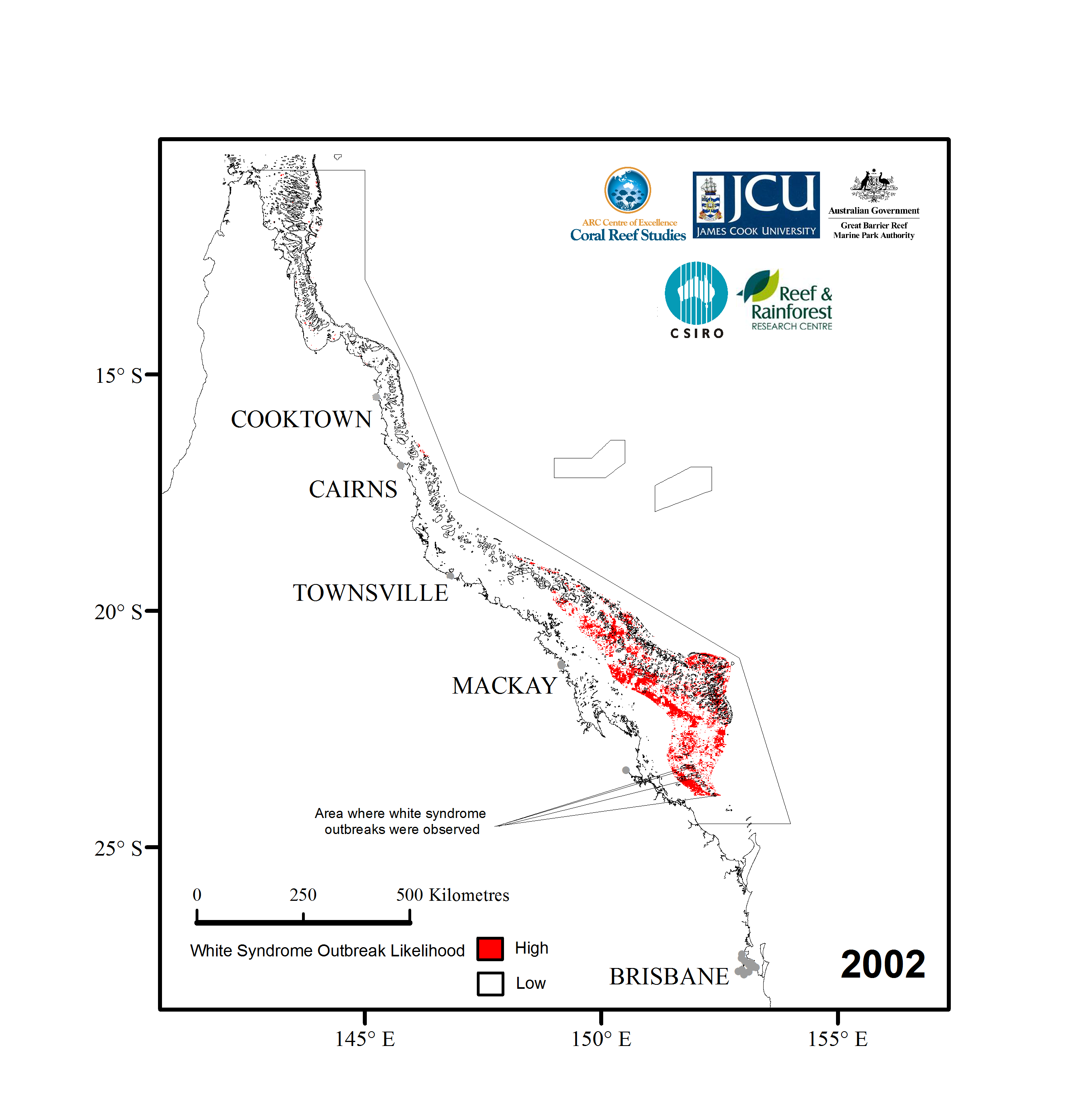
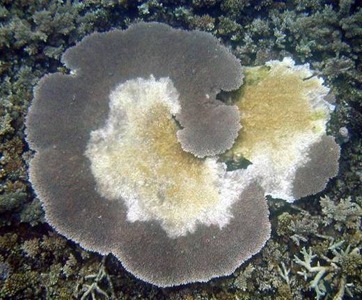
The most well documented outbreaks of white syndromes (WS) in Australia occurred in the southern and northern Great Barrier Reef in 2002. Temperature stress during the summer months of 2002 was far greater at outbreak sites than at most sites in northeastern Australia. The outbreak sites also had high coral cover (>45%).
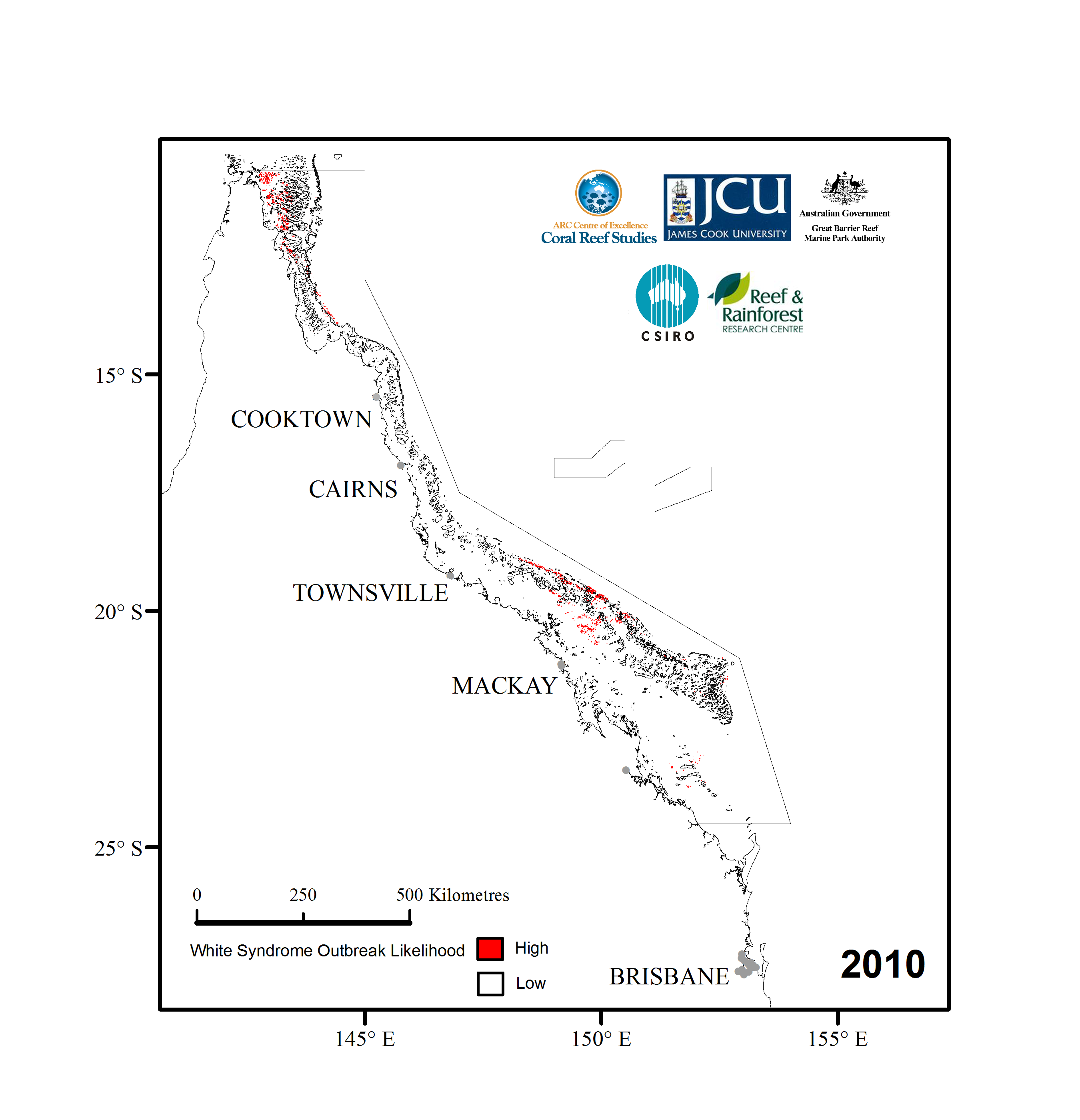
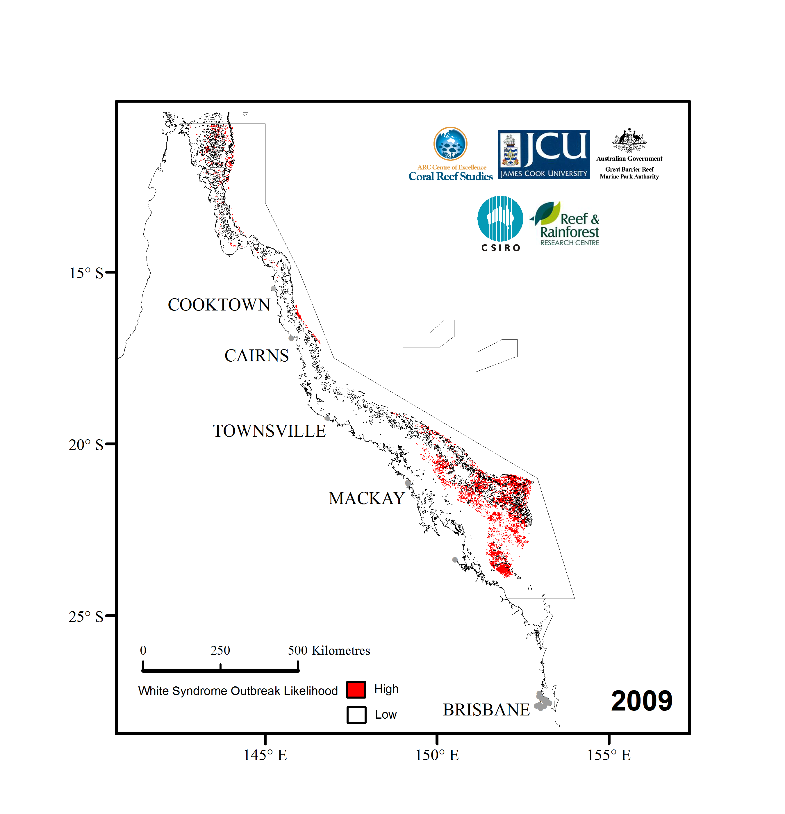
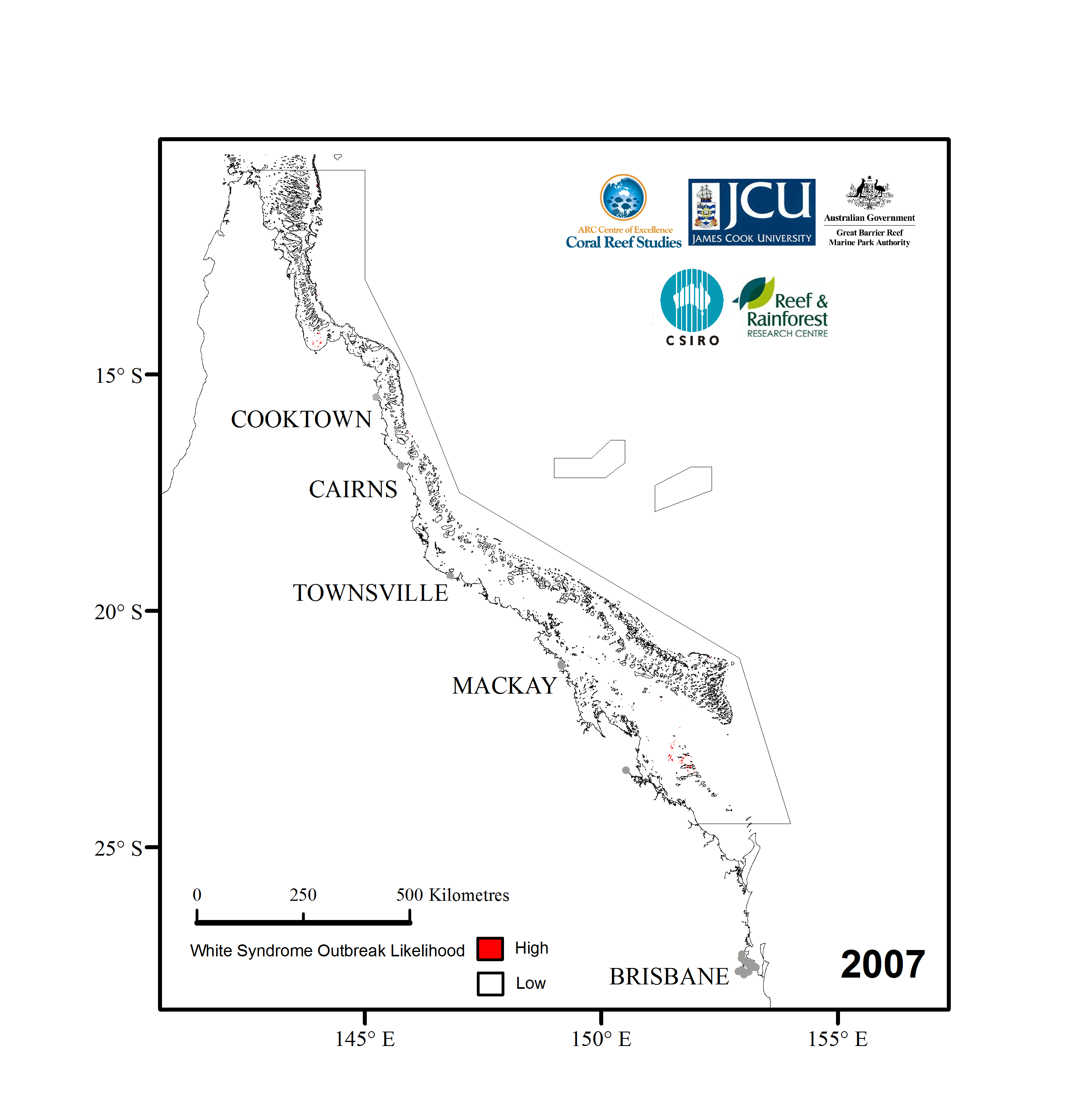
Temperature stress is measured by the average number of degrees above the long-term average. These mean positive summer anomaly values are calculated as an average accumulation of degree heating days [number of degrees above long-term (1991 to 2002) average temperature plus standard deviation] every day during the summer months (December to February). During 2002, all sites where WS outbreaks were observed had MPSA values greater than 0.3.
For each of the last 8 summers, MPSA values have been calculated for northern Australia using remotely sensed data from satellites at ~1 km resolution. Maps of WS outbreak risk have been produced by overlaying the maps of temperature stress with long-term average coral cover datasets from the AIMS - LTMP. The red colouration designates sites that experienced similar levels of temperature stress to those recorded during the 2002 outbreaks, and where LTMP monitoring data report coral cover > 26%. This is a conservative coral cover threshold given no sites were surveyed during the 2002 outbreak year that had between 26 and 45% cover. Since the maps target surveys at high outbreak likelihood sites, future monitoring can increase our understanding of the coral cover threshold required for a WS outbreak.
The maps of WS outbreak likelihood form the basis of an early warning system currently being developed as part of a coral disease outbreak response plan, under development by the Climate Change Group at the GBRMPA. The GBRMPA co-funded this work through the Marine and Tropical Sciences Research Facility and Reef and Rainforest Research Centre.
This project was lead by researchers from the Australian Research Councils Centre of Excellence for Coral Reef Studies and completed in collaboration with researchers from the Great Barrier Reef Marine Park Authority (GBRMPA), CSIRO Marine and Atmospheric Research, and NOAA Coral Reef Watch.
To view images of white syndrome outbreak likelihood through Google Earth, click here.

For full functionality this file requires you have Google Earth version 5 or later installed. The newest version of Google Earth and all related information can be found here.
The thumbnails below show locations where white syndrome outbreak likelihood (in red) was high from the years 2002 to 2010. Click on the thumbnail to see a larger version of the image.
Experimental Product - Research Use Only
| 2011 | 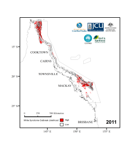 |
| 2010 |  |
| 2009 |  |
| 2008 | 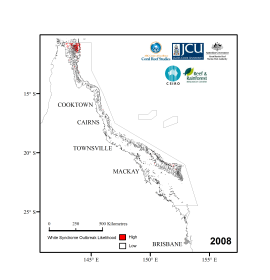 |
| 2007 |  |
| 2006 | 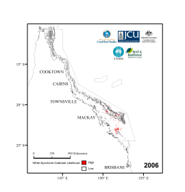 |
| 2005 |  |
| 2004 | 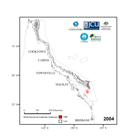 |
| 2003 |  |
| 2002 |  |
|