Voyage details and related metadata, reports, events and data.
ST 02/2008
(alternative identifier: ST200802)
- is a Marine National Facility ![]() voyage
voyage
Period: 2008-06-09 00:00 to 2008-06-18 00:00 UTC
Duration: 9.00 days
From: Suva To: Cairns
Region: Pacific Ocean; Coral Sea
Ship: Southern Surveyor [details]
Description: Southern Surveyor Transit voyage from Suva to Cairns. No voyage plan or summary expected.
Leader: R. Arculus (ANU)
Project: National Facility External Users: R. J. Arculus (ANU) [details]
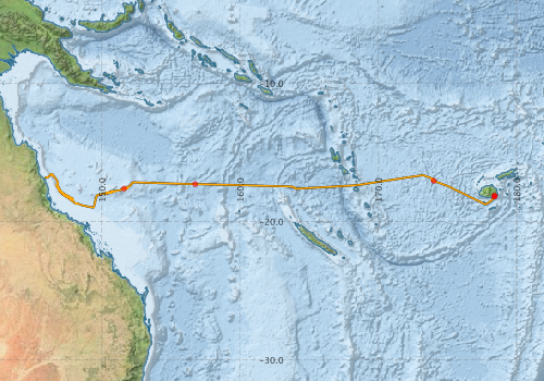
Voyage extents: 18° 59.7' S to 16° 31.3' S 145° 52.8' E to 178° 23.9' E Get voyage track shapefile Get CSV
Marlin Metadata:-
Participants - on ship:-
| Name | Role | Organisation |
|---|---|---|
| Drew Mills | Electronics support /Voyage Manager | CSIRO Oceans & Atmosphere - Hobart |
| Gordon Keith | Swath specialist | CSIRO Oceans & Atmosphere - Hobart |
| Hiski Kippo | Computing support | CSIRO Oceans & Atmosphere - Hobart |
| Rick Smith | Chief Scientist | CSIRO Oceans & Atmosphere - Hobart |
This list includes those that may have only been on part of the voyage. See voyage reports on 'Reports and Maps' tab for details.
Marine National Facility Reports - plans, summaries and data processing
-
ST200802 Voyage Plan
- includes objectives, investigator details, proposed data collection, voyage track and equipment to be used.
-

Publications, reports and datasets from this voyage.
Dataset
- Bakker, Dorothee C E; Pfeil, Benjamin; Smith, Karl; Hankin, Steven; Olsen, Are; Alin, Simone R; Cosca, Catherine E; Harasawa, Sumiko; Kozyr, Alexander; Nojiri, Yukihiro; O'Brien, Kevin M; Schuster, Ute; Telszewski, Maciej; Tilbrook, Bronte; Wada, Chisato; Akl, John; Barbero, Leticia; Bates, Nicolas R; Boutin, Jacqueline; Bozec, Yann; Cai, Wei-Jun; Castle, Robert D; Chavez, Francisco P; Chen, Lei; Chierici, Melissa; Currie, Kim I; de Baar, Hein J W; Evans, Wiley; Feely, Richard A; Fransson, Agneta; Gao, Zhongyong; Hales, Burke; Hardman-Mountford, Nicolas J; Hoppema, Mario; Huang, Wei-Jen; Hunt, Christopher W; Huss, Betty; Ichikawa, Tadafumi; Johannessen, Truls; Jones, Elizabeth M; Jones, Steve D; Jutterstrøm, Sara; Kitidis, Vassilis; Körtzinger, Arne; Landschützer, Peter; Lauvset, Siv K; Lefèvre, Nathalie; Manke, Ansley; Mathis, Jeremy T; Merlivat, Liliane; Metzl, Nicolas; Murata, Akihiko; Newberger, Timothy; Omar, Abdirahman M; Ono, Tsuneo; Park, Geun-Ha; Paterson, Kristina; Pierrot, Denis; Ríos, Aida F; Sabine, Christopher L; Saito, Shu; Salisbury, Joe; Sarma, Vedula V S S; Schlitzer, Reiner; Sieger, Rainer; Skjelvan, Ingunn; Steinhoff, Tobias; Sullivan, Kevin; Sun, Heng; Sutton, Adrienne; Suzuki, Toru; Sweeney, Colm; Takahashi, Taro; Tjiputra, Jerry; Tsurushima, Nobuo; van Heuven, Steven; Vandemark, Doug; Vlahos, Penny; Wallace, Douglas WR; Wanninkhof, Rik; Watson, Andrew J (2014): Surface Ocean CO2 Atlas (SOCAT) V2. PANGAEA, 10.1594/PANGAEA.811776
- Smith, S. R.,Lopez, N.,Bourassa, M. A. (2016) SAMOS air‐sea fluxes: 2005–2014. Geoscience Data Journal 3 pp9-19. 10.1002/gdj3.34
Search for publications, reports and datasets from this and other voyages
Data publishing
This is a list of online datasets hosted by CSIRO. Other processed datasets hosted by collaborating organisations may be found on the 'Metadata' or "Reports, Publications and Maps' tab.
Use the Get data link on the right to extract data using the NCMI Data Trawler.
| Data Stream | Data Summary | Get data | ||||||||||||
|---|---|---|---|---|---|---|---|---|---|---|---|---|---|---|
| ADCP Data |
|
Get Data from Trawler Download netCDF dataset st200802adcp.zip ST200802_UWY_ADCP_Report.pdf |
||||||||||||
| Multibeam echosounder |
|
Get Data from Trawler |
||||||||||||
| pCO2 |
|
External link - download datafile at IMOS |
||||||||||||
| Underway |
|
Get Data from Trawler |
Deployments by start time:- Click on column header to sort. Use link on 'Deployment' to see full details. Use the CSV button at the bottom to export data (tab delimited).
Search for deployments from this voyage and others
| Deployment | Operation | Station | Cast | Gear | Project | Start and end times | Start Location | End Location | Depth range | Max Depth | Description | |||
|---|---|---|---|---|---|---|---|---|---|---|---|---|---|---|
| Multibeam echosounder [details] | EM300 Multibeam Echosounder | 2008-06-08 03:15 | 2008-06-18 01:44 | -18.1317 | 178.4163 | -16.8214 | 145.8371 | 5227.2 | ||||||
| Underway System [details] | Air Temperature Sensor-HMP233,Barometer,Fluorometer WS3S-443P,Gyro-Generic SS-NF,Humidity Sensor-HMP233,Licor-UWQ 3708,RM Young 05106 wind monitor-75621,RM Young 05106 wind monitor-75621,RM Young 05106 wind monitor-75621,RM Young Rain Gauge,Seapath 200,Seapath 200,Simrad EA500 Echosounder,ThermoSalinoGraph (TSG)-SN 2753,ThermoSalinoGraph (TSG)-SN 2753 | 1707 | 2008-06-08 03:28 | 2008-06-18 01:15 | -18.1421 | 178.3977 | -16.7799 | 145.8792 | ||||||
| ADCP Data [details] | RDI Ocean Surveyor Acoustic Doppler current profiler | 1707 | 2008-06-08 03:45 | 2008-06-09 04:15 | -18.1836 | 178.3777 | -16.7861 | 145.9047 | 734 | |||||
| ADCP Data [details] | 1707 | 2008-06-09 04:42 | 2008-06-12 21:32 | -17.0581 | 173.9977 | -17.2876 | 156.8218 | 734 | ||||||
| ADCP Data [details] | 1707 | 2008-06-12 21:56 | 2008-06-13 02:36 | -17.2860 | 156.7453 | -17.2657 | 155.8015 | 335 | ||||||
| ADCP Data [details] | 1707 | 2008-06-14 02:07 | 2008-06-18 01:02 | -17.6044 | 151.5999 | -16.7861 | 145.9047 | 463 | ||||||