Voyage details and related metadata, reports, events and data.
ST 04/2007
(alternative identifier: ST200704)
- is a Marine National Facility ![]() voyage
voyage
Period: 2007-07-16 00:00 to 2007-07-24 00:00 UTC
Duration: 8.00 days
From: Darwin To: Madang
Region: Arafura Sea; Bismark Sea
Ship: Southern Surveyor [details]
Description:
The Cheshire Seamount lies close the the western tip of the Woodlark oceanic spreading ridge where it is actively propagating into continental crust, a globally unusual setting. This project aims to sample the crest of Cheshire Seamount and test the feature for hydrothermal activity. The work is closely related to SS200706, which immediately follows the transit and is an extension of previous MNF voyages led by CSIRO-ANU.
Voyage Objectives
Utilising high resoultion multibeam and sidescan images recently collected and provided by Nautilus Minerals, the primary objectives in this project are:
- To dredge sample the crest of Cheshire Seamount and other volcanic features of interest, with the aim of recovering fractional volcanic rocks.
- To test the volcano and these other features for hydrothermal activity, using CTD-hydrocasts, deep tow video, dredge and grab sampling.
Leader: C. Yeats (CSIRO Exploration and Mining)
Project: Southern Surveyor - general vessel operations, gear trials, etc. [details]
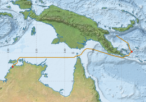
Voyage extents: 12° 28.2' S to 6° 55.9' S 130° 42.2' E to 151° 58.7' E Get voyage track shapefile Get CSV
Marlin Metadata:-
Participants - on ship:-
| Name | Role | Organisation |
|---|---|---|
| Camilla Stark | Swath Processing Support | CSIRO Exploration and Mining |
| Chris Yeats | Chief Investigator | CSIRO Exploration and Mining |
| Katerina Dodds | Technical Support (Student) | University of Western Australia |
| Shannon Johns | Science Watch Leader | CSIRO Exploration and Mining |
| TBA | MNF Electronics Support | CSIRO Oceans & Atmosphere - Hobart |
| TBA | MNF Computing Support | CSIRO Oceans & Atmosphere - Hobart |
This list includes those that may have only been on part of the voyage. See voyage reports on 'Reports and Maps' tab for details.
Marine National Facility Reports - plans, summaries and data processing
-
ST200704 Underway Data Processing Report
- details of data processing steps, calibration information, instruments used and any issues with the data.
-
ST200704 Voyage Plan
- includes objectives, investigator details, proposed data collection, voyage track and equipment to be used.
-

Search for publications, reports and datasets from this and other voyages
Data publishing
This is a list of online datasets hosted by CSIRO. Other processed datasets hosted by collaborating organisations may be found on the 'Metadata' or "Reports, Publications and Maps' tab.
Use the Get data link on the right to extract data using the NCMI Data Trawler.
| Data Stream | Data Summary | Get data | ||||||||||||
|---|---|---|---|---|---|---|---|---|---|---|---|---|---|---|
| CTD profile |
|
Get Data from Trawler st200704CTDnc.zip (Authorisation Required) ST200704_CTD_Report.pdf (Authorisation Required) |
||||||||||||
| Multibeam echosounder |
|
Get Data from Trawler |
||||||||||||
| Underway |
|
Get Data from Trawler |
Deployments by start time:- Click on column header to sort. Use link on 'Deployment' to see full details. Use the CSV button at the bottom to export data (tab delimited).
Search for deployments from this voyage and others
| Deployment | Operation | Station | Cast | Gear | Project | Start and end times | Start Location | End Location | Depth range | Max Depth | Description | |||
|---|---|---|---|---|---|---|---|---|---|---|---|---|---|---|
| Underway System [details] | Air Temperature Sensor-HMP233,Barometer,Fluorometer WS3S-1203,Gyro-Generic SS-NF,Humidity Sensor-HMP233,Licor-UWQ 3708,RM Young 05106 wind monitor-75621,RM Young 05106 wind monitor-75621,RM Young 05106 wind monitor-75621,RM Young Rain Gauge,Seapath 200,Seapath 200,Simrad EA500 Echosounder,ThermoSalinoGraph (TSG)-SS-SN 1777,ThermoSalinoGraph (TSG)-SS-SN 1777 | 1545 | 2007-07-15 09:57 | 2007-07-23 03:01 | -12.4694 | 130.8195 | -6.9304 | 149.0755 | ||||||
| Multibeam echosounder [details] | EM300 Multibeam Echosounder | 2007-07-15 09:57 | 2007-07-19 01:23 | -12.4695 | 130.8196 | -9.3056 | 144.4758 | 100 | ||||||
| CTD Cast [details] | 1 | Cast 1 | CTD 20 - SN 0552,Conductivity CTD 20-SN 3169,Pressure CTD 20,Temperature CTD 20-SN 2751 | 1545 | 2007-07-21 06:23 | 2007-07-21 07:29 | -9.7785 | 151.8136 | -9.7705 | 151.8130 | 1670 | |||
| CTD Cast [details] | 2 | Cast 2 | CTD 20 - SN 0552,Conductivity CTD 20-SN 3169,Pressure CTD 20,Temperature CTD 20-SN 2751 | 1545 | 2007-07-21 13:15 | 2007-07-21 14:41 | -9.8250 | 151.7975 | -9.8181 | 151.8004 | 2540 | |||