Voyage details and related metadata, reports, events and data.
ST 02/2007
(alternative identifier: ST200702)
- is a Marine National Facility ![]() voyage
voyage
Period: 2007-03-17 04:00 to 2007-03-22 20:00 UTC
Duration: 5.67 days
From: Port Lincoln To: Hobart
Region: Murray Canyons off Kangaroo Island, South Australia
Ship: Southern Surveyor [details]
Description:
To complete the vibracoring objectives of Southern Surveyor voyage SS02/2006.
Scientific Objectives of Southern Surveyor Transit 02/2007.
During voyage SS02/2006, using the sub-bottom profiler, several ancient courses of the River Murray were located along with the position of two extensive lacustrine deposits on the Lacepede Shelf. Many unsuccessful attempts were made at coring the sea floor using a gravity corer. There are two main objectives to this voyage:
- To obtain cores (vibocoring) from the ancient lake deposits on the Lacepede Shelf.
- To obtain additional information on the seafloor near the coast lines offshore Portland adjacent to the Glenelg River and offshore western Tasmania.
Leader: Professor P. De Deckker (ANU)
Project: National Facility External Users: P. De Deckker (ANU) [details]
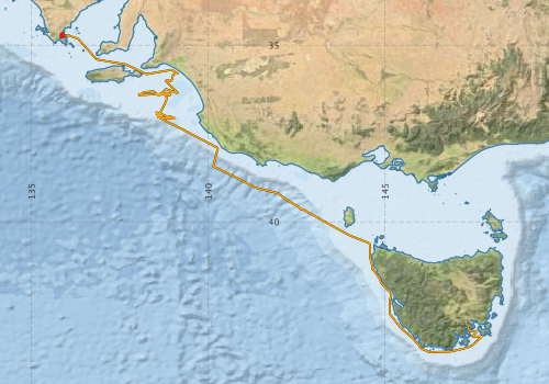
Voyage extents: 43° 41.6' S to 34° 42.6' S 135° 52.2' E to 147° 45.5' E Get voyage track shapefile Get CSV
Marlin Metadata:-
Participants - on ship:-
| Name | Role | Organisation |
|---|---|---|
| Andrew Hislop | Vibrocoring | Geoscience Australia |
| Bernadette Heaney | Computing Support | CSIRO Oceans & Atmosphere - Hobart |
| Chris von der Borch | Principal Investigator, marine geologist, sedimentologist | Australian National University - Research School of Earth Sciences |
| Craig Wintle | Vibrocoring | Geoscience Australia |
| Graham Nash | Undergraduate student | Australian National University |
| John Rogers | PhD student | Australian National University |
| Louise Soroka | Undergraduate student | Australian National University |
| Michele Spinoccia | Geophysicist, swath mapping support | Geoscience Australia |
| Nigel Craddy | Technical support | Australian National University |
| Patrick De Deckker | Chief Investigator | Australian National University |
| Peter Dunn | Voyage Manager, Electronics Support | CSIRO Oceans & Atmosphere - Hobart |
| Peter Hill | Principal Investigator, geophysicist | Australian National University - Research School of Earth Sciences |
| Sophie Bretherton | PhD student | Australian National University |
This list includes those that may have only been on part of the voyage. See voyage reports on 'Reports and Maps' tab for details.
Marine National Facility Reports - plans, summaries and data processing
-
ST200702 Voyage Plan
- includes objectives, investigator details, proposed data collection, voyage track and equipment to be used.
-
ST200702 Underway Data Processing Report
- details of data processing steps, calibration information, instruments used and any issues with the data.
-
ST200702 Scientific Highlight
- report of the key outputs
-
ST200702 Voyage Summary
- includes preliminary results, voyage narrative, types of data collected with C77/ROSCOP codes.
-

Publications, reports and datasets from this voyage.
Journal Article
- Hill, P. J.,De Deckker†, P.,von der Borch, C.,Murray-Wallace, C. V. (2009) Ancestral Murray River on the Lacepede Shelf, southern Australia: Late Quaternary migrations of a major river outlet and strandline development. Australian Journal of Earth Sciences 56 pp135-157. 10.1080/08120090802546993
- Power, H. E.,Clarke, S. L. (2019) 3D seismic-derived bathymetry: a quantitative comparison with multibeam data. Geo-Marine Letters 39 pp447-467. 10.1007/s00367-019-00596-w
Search for publications, reports and datasets from this and other voyages
Data publishing
This is a list of online datasets hosted by CSIRO. Other processed datasets hosted by collaborating organisations may be found on the 'Metadata' or "Reports, Publications and Maps' tab.
Use the Get data link on the right to extract data using the NCMI Data Trawler.
| Data Stream | Data Summary | Get data | ||||||||||||
|---|---|---|---|---|---|---|---|---|---|---|---|---|---|---|
| Multibeam echosounder |
|
Get Data from Trawler |
||||||||||||
| Underway |
|
Get Data from Trawler |
Deployments by start time:- Click on column header to sort. Use link on 'Deployment' to see full details. Use the CSV button at the bottom to export data (tab delimited).
Search for deployments from this voyage and others
| Deployment | Operation | Station | Cast | Gear | Project | Start and end times | Start Location | End Location | Depth range | Max Depth | Description | |||
|---|---|---|---|---|---|---|---|---|---|---|---|---|---|---|
| Underway System [details] | Air Temperature Sensor-HMP233,Barometer,Fluorometer WS3S-443P,Gyro-Generic SS-NF,Humidity Sensor-HMP233,Licor-UWQ 3708,RM Young 05106 wind monitor-75621,RM Young 05106 wind monitor-75621,RM Young 05106 wind monitor-75621,RM Young Rain Gauge,Seapath 200,Seapath 200,Simrad EA500 Echosounder,ThermoSalinoGraph (TSG)-SS-SN 1777,ThermoSalinoGraph (TSG)-SS-SN 1777 | 125 | 2007-03-17 06:03 | 2007-03-22 19:39 | -34.7167 | 135.8701 | -42.8948 | 147.3591 | ||||||
| Multibeam echosounder [details] | EM300 Multibeam Echosounder | 2007-03-17 06:22 | 2007-03-22 19:49 | -34.7170 | 135.8710 | -42.8861 | 147.3388 | 3198 | ||||||