Please login if you have access to particular applications.
Provider: All providers | |
Coastal Shelfs 0-200m | |
| Name: | 0-40 m North-West shelf - view region report showing all data |
| Region: | North-west |
| Area: | not set |
| Gear type: | eXpendable BathyThermograph
|
| Layers used: |
XBT Profile Data
- link to layer metadata |
| Summary: | Records - 312 Deepest: db |
| Last updated: | 25-Jul-2024 00:23. |
| Buffer: | |
Time series plot (1930 to present) - Y axis is deployments per year
Region data
Show data list
| Year | Total inside region |
| 1984 | 1 |
| 1985 | 16 |
| 1986 | 3 |
| 1987 | 1 |
| 1988 | 2 |
| 1989 | 4 |
| 1990 | 20 |
| 1991 | 35 |
| 1992 | 16 |
| 1993 | 47 |
| 1994 | 6 |
| 1995 | 3 |
| 1996 | 3 |
| 1997 | 15 |
| 1998 | 1 |
| 1999 | 9 |
| 2000 | 1 |
| 2001 | 1 |
| 2002 | 1 |
| 2003 | 1 |
| 2005 | 13 |
| 2007 | 16 |
| 2008 | 39 |
| 2009 | 5 |
| 2010 | 17 |
| 2011 | 17 |
| 2012 | 1 |
| 2013 | 1 |
| 2014 | 17 |
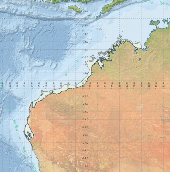
Region extents: 112° 54.5' E 27° 42.6' S to 129° 01.8' E 12° 18.7' S
Acknowledgements: Background map - Bright Earth e-Atlas Basemap v1.0 (AIMS, GBRMPA, JCU, DSITIA, GA, UCSD, NASA, OSM, ESRI) CC BY