
 Franklin Voyage FR 09/87 CTD
Data
Franklin Voyage FR 09/87 CTD
Data
Short title : FR 09/87 CTD
MarLIN record number : 4262
Anzlic Identifier :
ANZCW0306004262
Data Type
- Observed Data - field
CMR Vessel Data: CTD
Custodian Organisation : CSIRO
Division of Marine Research - Hobart
G.P.O. Box 1538
Hobart
TAS
Australia
7000
http://www.marine.csiro.au/marlinsearch/www.marine.csiro.au
Jurisdiction : Australia
Contributors : Refer to
processing report
Acknowledgements :
References : Franklin National
Facility (1987). Cruise Plan, Cruise FR 09/87. Miscellaneous Publication.
CSIRO Division of Oceanography [for] Franklin National Facility, 3 pp.
Franklin National Facility (1987). Research Summary, Cruise FR 09/87.
Miscellaneous Publication. CSIRO Division of Oceanography [for] Franklin
National Facility, 17 pp.
Abstract : This dataset contains
the processed Conductivity-Temperature-Depth (CTD) data collected on Franklin
voyage FR 06/87. The voyage took place in the Indian Ocean during 2 October -
2 November 1987. This dataset has been processed and is archived within the
CSIRO Marine Research Data Centre in Hobart. Additional information regarding
this dataset is contained in the cruise report for this voyage and/or the data
processing report (as available).
Documentation Links
- CTD Data
Format Description
Data Request Form
Processing
report for this dataset (authorisation required)
Data Links
- Download
dataset 0.9 / 3.4 Mb (authorisation required)
Data available via Data
Trawler - Access: Public
Location Keywords
- Australia > Western Australia Coast North
Christmas Island
Indian Ocean
ANZLIC Geographic Extent Names
(Category, [Jurisdiction], Name)
- External Territories, [Australia], Territory of Christmas Island
Ocean
and Sea Regions, [Australia], Indian Ocean
Ocean and Sea Regions,
[Australia], Western Australia - North Coast
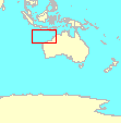
Geographic Extent
-
|
10.0 S |
|
| 105.6 E |
|
126.0 E |
|
22.0 S |
|
C-squares references
- 3211:123:2, 3211:113:4, 3211:114:1, 3211:206:2, 3211:206:1,
3111:496:3, 3111:495:4, 3111:495:1, 3111:394:2, 3111:495:2, 3111:384:3,
3111:383:1, 3111:382:2, 3111:372:3, 3111:371:4, 3112:371:1, 3111:370:2,
3112:370:2, 3112:360:4, 3111:360:3, 3110:469:3, 3112:360:3, 3111:469:2,
3111:469:1, 3110:469:1, 3111:458:4, 3111:458:3, 3110:458:2, 3111:457:2,
3111:247:3, 3110:248:3, 3111:246:2, 3110:247:2, 3111:235:4, 3111:134:1,
3110:237:1, 3112:235:2, 3112:225:3, 3111:122:4, 3110:227:3, 3112:124:4,
3111:121:2, 3112:124:1, 3112:122:2, 3112:123:1, 3110:216:4, 3112:112:3,
3111:110:3, 3110:217:1, 3110:216:2, 3110:205:3, 3110:205:1, 3110:206:2,
3110:205:2, 3010:496:4, 3010:496:2
Subject Categories and Search Word(s)
MarLIN Subject Categories
- 2144/1144. Descriptive oceanography and limnology - regional
studies/expeditions/data reports
2146/1146. Water masses, circulation,
temperature-salinity-depth studies
GCMD Keywords
- EARTH SCIENCE > Oceans > Ocean Pressure > Water Pressure
EARTH SCIENCE > Oceans > Ocean Temperature > Water Temperature
EARTH SCIENCE > Oceans > Salinity/Density > Salinity
ANZLIC Search Words
- OCEANOGRAPHY
OCEANOGRAPHY Physical
Equipment
- CTDs (Conductivity-Temperature-Depth Profilers)
Additional equipment information
- Research Vessels
Taxonomic information
- _
Originating Research Project
Project Name
- Regional Oceanographic Studies (+ successors) 1981-1997
Project Leader(s)
- George Cresswell - (Former) CSIRO Division of Oceanography - Hobart
Project Duration
- 1981 - 1997
Project Description
Research Platform, Site or
Source
- Franklin
Research Voyage/Survey Details
Voyage/Survey Name
- FR 09/87 [FR198709]
Voyage/Survey Leader(s)
- G. Cresswell (CSIRO)
Voyage/Survey Region
- NW Australia/Christmas Island
Voyage/Survey Description
- Cruise FR 09/87 was undertaken to examine the currents and water
properties in the triangle formed by NW Australia and the Indonesian
Archipelago with emphasis on the Pacific Indian Ocean throughflow, the South
Equatorial Current, various subsurface features, mixing in the thermocline and
currents on the NW Shelf. Examination of the relationship between seabird
distribution, ecology and water masses and dredging of bottom samples to
understand the origins of Christmas Island and the Sherbakov Seamounts were
also conducted. Survey methods included CTD casts, XBT's, Pegasus current
profiler, dredges, underway surface water properties, underway current
profiles, one new satellite drifter released, five older drifters monitored,
accurate soundings with GPS fixes, meteorological and bird observations.
Laboratory studies will be conducted on sediment and rock samples collected.
Voyage Track
- View
voyage track
Beginning date : 04 Oct 1987
Ending date : 31 Oct 1987
Progress : Complete
Maintenance and Update Frequency :
Not Planned
Stored Data Format(s)
- DIGITAL - Text Documents - ASCII
On-line
Stored Data Volume
- 1 file, 3316309 bytes uncompressed, 888438 bytes compressed
Specific Software Requirements
Stored Data Documentation
- Format description available; see "Documentation Link"
Stored Data Location
- c/o Divisional Data Centre, Hobart
Additional project level storage
information for this dataset is available via the edit interface.
CD List
 FR 09/1987 Complete
Data (CD ref: FR198709a_1) details
FR 09/1987 Complete
Data (CD ref: FR198709a_1) details
Available Format Type(s)
- DIGITAL - Text Documents - ASCII
Access constraint
- Datasets are embargoed except to the Principal Investigator (PI) for 2
years from date of processing.
For datasets out of embargo, contact the
Divisional Data Centre for authorisation to access this dataset via the Data
Link (see "Links" section).
Data Source, Processing and Quality Control
Information
- Data source: original field data
Data processing and quality control:
according to current CMR Data Centre CTD data processing manual. For full
details, refer to documentation.
Positional accuracy
- Refer to documentation
Parameter accuracy
- Refer to documentation
Logical consistency report
- Refer custodian for details of logical checks carried out on the data
Completeness
- Some gaps in the data. For full details refer to the data processing
report under the documentation link.
Contact
- Divisional Data Centre
CSIRO Division of Marine Research - Hobart
G.P.O. Box 1538
Hobart
TAS Australia
7001
data-requests@marine.csiro.au
Related Datasets
- Arafura
Sea/Gulf of Carpentaria Current Meter (Mooring) Data 1987-8
Evans
Head Current Meter (Mooring) Data 1989-90
Franklin
Voyage FR 01/86 CTD Data
Franklin
Voyage FR 01/86 Expendable Bathythermograph (XBT) Data
Franklin
Voyage FR 01/86 Hydrology Data
Franklin
Voyage FR 01/86 Underway Data
Franklin
Voyage FR 02/87 CTD Data
Franklin
Voyage FR 02/87 Hydrology Data
Franklin
Voyage FR 02/87 Underway Data
Franklin
Voyage FR 03/88 ADCP Data
Franklin
Voyage FR 03/88 CTD Data
Franklin
Voyage FR 03/88 Hydrology Data
Franklin
Voyage FR 03/88 Underway Data
Franklin
Voyage FR 04/85 CTD Data
Franklin
Voyage FR 04/85 Expendable Bathythermograph (XBT) Data
Franklin
Voyage FR 04/85 Hydrology Data
Franklin
Voyage FR 04/85 Underway Data
Franklin
Voyage FR 05/95 ADCP Data
Franklin
Voyage FR 05/95 CTD Data
Franklin
Voyage FR 05/95 Hydrology Data
Franklin
Voyage FR 05/95 Underway Data
Franklin
Voyage FR 08A/86 CTD Data
Franklin
Voyage FR 08A/86 Expendable Bathythermograph (XBT) Data
Franklin
Voyage FR 08A/86 Hydrology Data
Franklin
Voyage FR 08A/86 Underway Data
Franklin
Voyage FR 09/87 ADCP Data
Franklin
Voyage FR 09/87 Hydrology Data
Franklin
Voyage FR 09/87 Underway Data
Franklin
Voyage FR 11/94 ADCP Data
Franklin
Voyage FR 11/94 CTD Data
Franklin
Voyage FR 11/94 Expendable Bathythermograph (XBT) Data
Franklin
Voyage FR 11/94 Hydrology Data
Franklin
Voyage FR 11/94 Underway Data
Franklin
Voyage FR 13/89 ADCP Data
Franklin
Voyage FR 13/89 CTD Data
Franklin
Voyage FR 13/89 Expendable Bathythermograph (XBT) Data
Franklin
Voyage FR 13/89 Hydrology Data
Franklin
Voyage FR 13/89 Underway Data
Halmahera
Sea Current Meter (Mooring) Data 1993-4
Makassar
Strait Current Meter (Mooring) Data 1993-4
Maluku
Strait Current Meter (Mooring) Data 1993-4
Timor
Sea Current Meter (Mooring) Data 1988
Metadata Access
- Public
Metadata Entry Created
- 19-Oct-1998 by Angela Way
Metadata Last Updated
- 17-Aug-2001 by Terry Byrne
Metadata Export
- Show ANZLIC core metadata in ANZLIC
XML format
Metadata Updateable By
- Angela Way
Edit
this MarLIN record (authorisation required)
This record reflects the content of CSIRO Marine Laboratories
Information Network as at 20 May 2004. It is provided for information purposes
only and is subject to CSIRO's legal notice and
disclaimer. Please notify any errors or omissions to mailto:tony.rees@csiro.au